Suriānwān night lights from space
Night Light of Suriānwān (Uttar Pradesh) from space (India) Src. Average luminocity for 10x10km area is 25.5% and for 50x50km: 28.4416%.
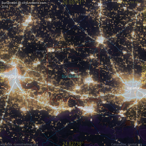
Analysis of Suriānwān night lights 2016
Square area 10x10 km:
 1.79%
1.79%90-99
3.37%80-89
0.99%70-79
0.2%60-69
0%50-59
3.97%40-49
6.35%30-39
11.11%20-29
16.07%10-19
35.52%0-9
20.63%Square area 50x50 km:
1.54%90-99
2.54%80-89
1.71%70-79
2.79%60-69
3.62%50-59
5.96%40-49
9.43%30-39
11.37%20-29
14.11%10-19
17.35%0-9
29.58%Clear (daylight) street map image can be seen on geolist.org.
Map coordinates:
26° 5' 49.2" North, 81° 42' 58" East
25° 27' 49.9" North, 82° 25' 9.2" East
24° 49' 38.6" North, 83° 7' 20.5" East
Some cities around Suriānwān sort by population:
• Mirzāpur
38.4 km =23.9 mi,  157°
157°
• Bhadohi
17 km =10.6 mi,  116°
116°
• Machhlīshahr
24.7 km =15.3 mi,  358°
358°
• Phulpur
34.4 km =21.4 mi,  285°
285°
• Mariāhu
24.2 km =15 mi,  49°
49°
• Handiā
25.9 km =16.1 mi,  244°
244°
• Gyānpur
15.3 km =9.5 mi, 162°
• Sirsā
39.7 km =24.7 mi, 235°
1255346 (p: 19,157)
Sources (retrieved 2019-11-25):
» Earth at Night: Flat Maps 2012, 2016