Bhābhra night lights from space
Night Light of Bhābhra (Madhya Pradesh) from space (India) Src. Average luminocity for 10x10km area is 2.8277% and for 50x50km: 2.4001%.
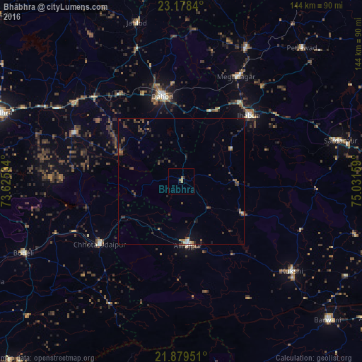
Analysis of Bhābhra night lights 2016
Square area 10x10 km:
 0%
0%90-99
0%80-89
0%70-79
0.76%60-69
2.08%50-59
0.19%40-49
0%30-39
0.19%20-29
1.33%10-19
0.19%0-9
95.27%Square area 50x50 km:
0.05%90-99
0.2%80-89
0.02%70-79
0.19%60-69
0.46%50-59
0.35%40-49
0.72%30-39
0.97%20-29
0.98%10-19
1.15%0-9
94.92%Clear (daylight) street map image can be seen on geolist.org.
Map coordinates:
23° 10' 42.2" North, 73° 37' 31.2" East
22° 31' 49.7" North, 74° 19' 42.5" East
21° 52' 46.2" North, 75° 1' 53.7" East
Some cities around Bhābhra sort by population:
• Dohad
34.3 km =21.3 mi,  348°
348°
• Jhābua
37.7 km =23.4 mi,  45°
45°
• Rajpur
25.3 km =15.7 mi,  173°
173°
• Chhota Udepur
40.8 km =25.4 mi,  231°
231°
• Devgadh Bāriya
47.2 km =29.3 mi,  294°
294°
• Jobat
27.7 km =17.2 mi,  117°
117°
• Rānāpur
23.7 km =14.7 mi,  56°
56°
• Bāg
51.2 km =31.8 mi,  111°
111°
1276374 (p: 9,965)
Sources (retrieved 2019-11-25):
» Earth at Night: Flat Maps 2012, 2016