Barwādih night lights from space
Night Light of Barwādih (Jharkhand) from space (India) Src. Average luminocity for 10x10km area is 4.3353% and for 50x50km: 2.7165%.
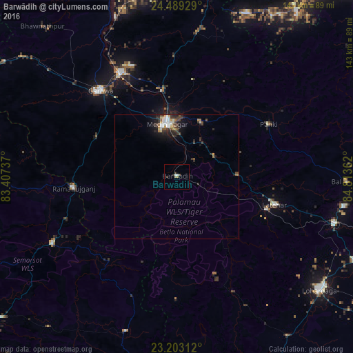
Analysis of Barwādih night lights 2016
Square area 10x10 km:
 0.2%
0.2%90-99
1.39%80-89
0%70-79
0%60-69
0.79%50-59
1.19%40-49
0.4%30-39
1.59%20-29
0.79%10-19
0.2%0-9
93.45%Square area 50x50 km:
0.39%90-99
0.53%80-89
0.15%70-79
0.28%60-69
0.28%50-59
0.33%40-49
0.49%30-39
0.85%20-29
0.64%10-19
1.58%0-9
94.5%Clear (daylight) street map image can be seen on geolist.org.
Map coordinates:
24° 29' 21.4" North, 83° 24' 26.5" East
23° 50' 52.1" North, 84° 6' 37.8" East
23° 12' 11.2" North, 84° 48' 49" East
Some cities around Barwādih sort by population:
• Daltonganj
21.8 km =13.5 mi,  347°
347°
• Lohārdagā
74.1 km =46 mi,  128°
128°
• Chatrā
86.9 km =54 mi,  62°
62°
• Garhwa
46.4 km =28.8 mi,  318°
318°
• Husainābād
76.5 km =47.5 mi, 351°
• Nabīnagar
84.4 km =52.4 mi,  1°
1°
• Lātehār
41.3 km =25.7 mi,  106°
106°
• Rāmānuj Ganj
42 km =26.1 mi,  263°
263°
1276819 (p: 7,401)
Sources (retrieved 2019-11-25):
» Earth at Night: Flat Maps 2012, 2016