Daltonganj night lights from space
Night Light of Daltonganj (Jharkhand) from space (India) Src. Average luminocity for 10x10km area is 44.9773% and for 50x50km: 5.3588%.
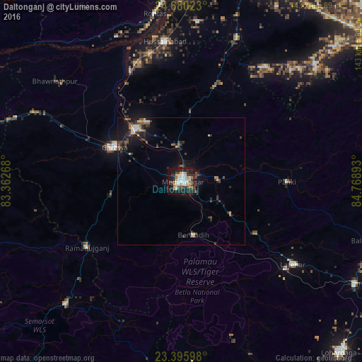
Analysis of Daltonganj night lights 2016
Square area 10x10 km:
 8.9%
8.9%90-99
11.17%80-89
3.6%70-79
5.68%60-69
3.41%50-59
3.79%40-49
3.79%30-39
13.07%20-29
12.5%10-19
29.73%0-9
4.36%Square area 50x50 km:
0.61%90-99
0.76%80-89
0.36%70-79
0.55%60-69
0.48%50-59
0.78%40-49
0.86%30-39
1.51%20-29
1.46%10-19
5.12%0-9
87.5%Clear (daylight) street map image can be seen on geolist.org.
Map coordinates:
24° 40' 48.8" North, 83° 21' 45.6" East
24° 2' 23" North, 84° 3' 56.9" East
23° 23' 45.5" North, 84° 46' 8.1" East
Some cities around Daltonganj sort by population:
• Aurangābād
85.1 km =52.9 mi,  21°
21°
• Chatrā
83.8 km =52.1 mi,  77°
77°
• Garhwa
29.4 km =18.3 mi,  297°
297°
• Husainābād
54.8 km =34.1 mi,  353°
353°
• Nabīnagar
63.4 km =39.4 mi,  5°
5°
• Lātehār
55 km =34.2 mi,  126°
126°
• Rāmānuj Ganj
45.4 km =28.2 mi,  235°
235°
• Barwādih
21.8 km =13.5 mi,  167°
167°
1273626 (p: 77,704)
Sources (retrieved 2019-11-25):
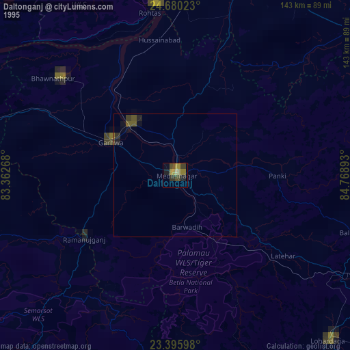
» NASA, Earths city lights 1995
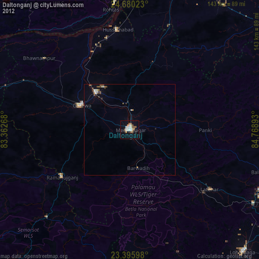
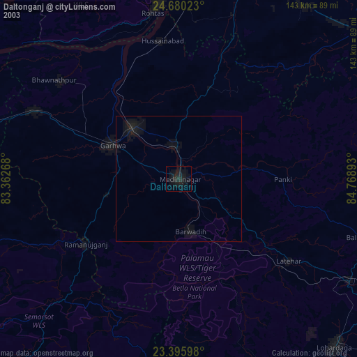
» NASA city lights 2003
» Earth at Night: Flat Maps 2012, 2016