Bārdoli night lights from space
Night Light of Bārdoli (Gujarat) from space (India) Src. Average luminocity for 10x10km area is 37.2341% and for 50x50km: 25.8596%.
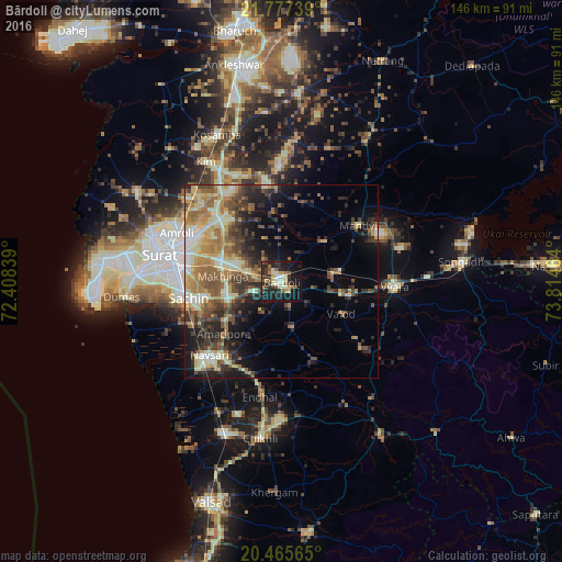
Analysis of Bārdoli night lights 2016
Square area 10x10 km:
 1.79%
1.79%90-99
9.33%80-89
4.56%70-79
5.16%60-69
3.37%50-59
6.15%40-49
3.97%30-39
7.94%20-29
14.88%10-19
32.74%0-9
10.12%Square area 50x50 km:
1.41%90-99
5.04%80-89
4.27%70-79
3.76%60-69
4.46%50-59
4.37%40-49
4.87%30-39
5.22%20-29
6.34%10-19
10.09%0-9
50.16%Clear (daylight) street map image can be seen on geolist.org.
Map coordinates:
21° 46' 38.6" North, 72° 24' 30.2" East
21° 7' 22.7" North, 73° 6' 41.4" East
20° 27' 56.3" North, 73° 48' 52.7" East
Some cities around Bārdoli sort by population:
• Navsāri
27.9 km =17.3 mi,  223°
223°
• Vyāra
29.3 km =18.2 mi,  92°
92°
• Māndvi
24.8 km =15.4 mi,  53°
53°
• Jalālpur
29.4 km =18.3 mi,  228°
228°
• Kadod
15.3 km =9.5 mi, 46°
• Kāthor
25.5 km =15.8 mi,  316°
316°
• Utrān
28.2 km =17.5 mi,  295°
295°
• Sachīn
24.2 km =15 mi,  260°
260°
1277022 (p: 57,810)
Sources (retrieved 2019-11-25):
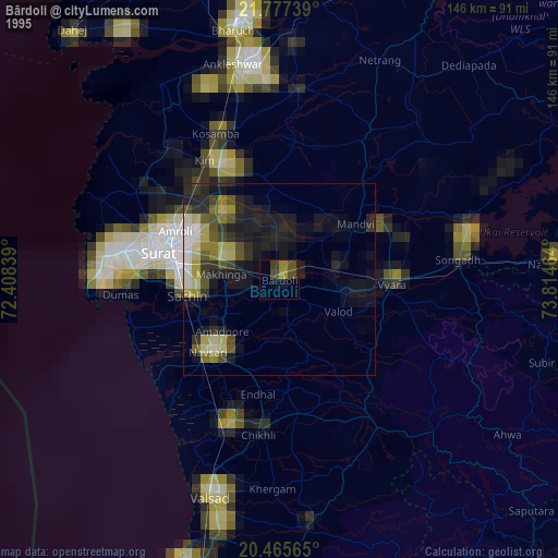
» NASA, Earths city lights 1995
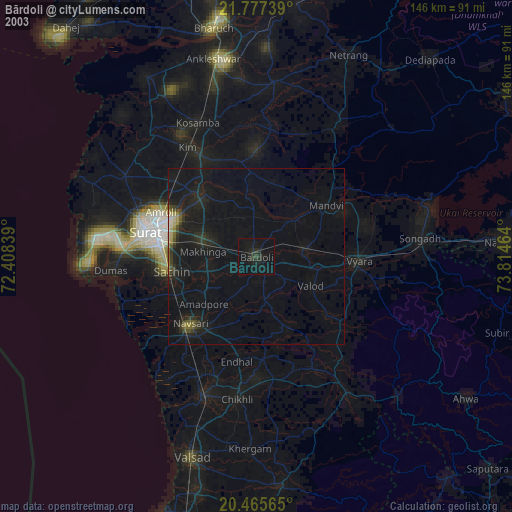
» NASA city lights 2003
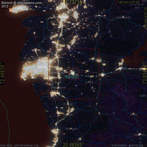
» Earth at Night: Flat Maps 2012, 2016