Vyāra night lights from space
Night Light of Vyāra (Gujarat) from space (India) Src. Average luminocity for 10x10km area is 21.5615% and for 50x50km: 6.9401%.
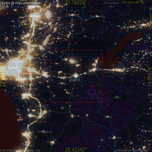
Analysis of Vyāra night lights 2016
Square area 10x10 km:
 0%
0%90-99
5.16%80-89
3.37%70-79
2.38%60-69
2.18%50-59
2.78%40-49
3.57%30-39
2.78%20-29
4.17%10-19
17.86%0-9
55.75%Square area 50x50 km:
0.14%90-99
0.79%80-89
0.83%70-79
0.57%60-69
0.84%50-59
1.19%40-49
1.31%30-39
1.5%20-29
2.18%10-19
5.4%0-9
85.26%Clear (daylight) street map image can be seen on geolist.org.
Map coordinates:
21° 45' 54.9" North, 72° 41' 25.9" East
21° 6' 38.8" North, 73° 23' 37.1" East
20° 27' 12.3" North, 74° 5' 48.4" East
Some cities around Vyāra sort by population:
• Bārdoli
29.3 km =18.2 mi,  272°
272°
• Songadh
18.8 km =11.7 mi,  69°
69°
• Māndvi
18.6 km =11.6 mi,  329°
329°
• Kadod
21.6 km =13.4 mi,  303°
303°
• Kāthor
50.9 km =31.6 mi,  292°
292°
• Ahwa
49.7 km =30.9 mi,  142°
142°
• Vānsada
39.3 km =24.4 mi,  184°
184°
• Waghāi
39.4 km =24.5 mi,  163°
163°
1253074 (p: 38,168)
Sources (retrieved 2019-11-25):
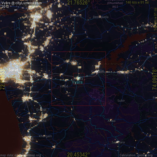
» Earth at Night: Flat Maps 2012, 2016