Bail-Hongal night lights from space
Night Light of Bail-Hongal (Karnataka) from space (India) Src. Average luminocity for 10x10km area is 20.9762% and for 50x50km: 3.1485%.
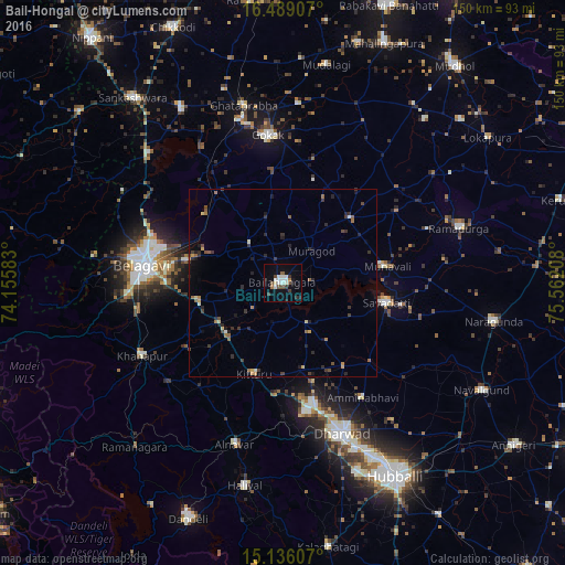
Analysis of Bail-Hongal night lights 2016
Square area 10x10 km:
 3.03%
3.03%90-99
6.49%80-89
0.87%70-79
0%60-69
1.73%50-59
3.03%40-49
2.81%30-39
2.81%20-29
3.46%10-19
11.9%0-9
63.85%Square area 50x50 km:
0.13%90-99
0.37%80-89
0.3%70-79
0.25%60-69
0.41%50-59
0.54%40-49
0.5%30-39
0.81%20-29
1.11%10-19
1.12%0-9
94.46%Clear (daylight) street map image can be seen on geolist.org.
Map coordinates:
16° 29' 20.7" North, 74° 9' 21" East
15° 48' 49.3" North, 74° 51' 32.2" East
15° 8' 9.9" North, 75° 33' 43.5" East
Some cities around Bail-Hongal sort by population:
• Belgaum
38.2 km =23.7 mi,  276°
276°
• Gokak
39.7 km =24.7 mi,  354°
354°
• Saundatti
28.2 km =17.5 mi,  100°
100°
• Hukeri
53.9 km =33.5 mi,  329°
329°
• Konnūr
44.7 km =27.8 mi,  344°
344°
• Khānāpur
42.2 km =26.2 mi,  242°
242°
• Alnāvar
44.8 km =27.8 mi,  196°
196°
• Londa
52.8 km =32.8 mi,  223°
223°
1277765 (p: 47,063)
Sources (retrieved 2019-11-25):
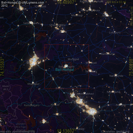
» Earth at Night: Flat Maps 2012, 2016