Khānāpur night lights from space
Night Light of Khānāpur (Karnataka) from space (India) Src. Average luminocity for 10x10km area is 6.5476% and for 50x50km: 5.6543%.
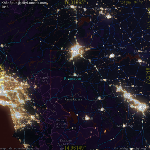
Analysis of Khānāpur night lights 2016
Square area 10x10 km:
 0.65%
0.65%90-99
2.38%80-89
0.43%70-79
0%60-69
0.87%50-59
1.73%40-49
0%30-39
1.73%20-29
0%10-19
0%0-9
92.21%Square area 50x50 km:
1.06%90-99
0.92%80-89
0.45%70-79
0.31%60-69
1.1%50-59
0.72%40-49
0.78%30-39
1.15%20-29
1.79%10-19
2.54%0-9
89.19%Clear (daylight) street map image can be seen on geolist.org.
Map coordinates:
16° 18' 56.3" North, 73° 48' 19.3" East
15° 38' 22.9" North, 74° 30' 30.5" East
14° 57' 41.4" North, 75° 12' 41.8" East
Some cities around Khānāpur sort by population:
• Belgaum
23.6 km =14.7 mi,  358°
358°
• Dandeli
43.1 km =26.8 mi,  164°
164°
• Bail-Hongal
42.2 km =26.2 mi,  62°
62°
• Haliyal
43.6 km =27.1 mi,  142°
142°
• Alnāvar
34.3 km =21.3 mi,  133°
133°
• Valpoy
41.6 km =25.8 mi,  253°
253°
• Londa
19 km =11.8 mi,  176°
176°
• Palle
49.4 km =30.7 mi, 247°
1267065 (p: 17,216)
Sources (retrieved 2019-11-25):
» Earth at Night: Flat Maps 2012, 2016