Gokak night lights from space
Night Light of Gokak (Karnataka) from space (India) Src. Average luminocity for 10x10km area is 27.6426% and for 50x50km: 4.9429%.
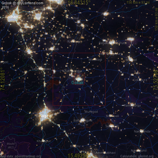
Analysis of Gokak night lights 2016
Square area 10x10 km:
 4.34%
4.34%90-99
4.34%80-89
3.51%70-79
1.86%60-69
2.48%50-59
4.13%40-49
4.34%30-39
3.31%20-29
1.86%10-19
39.67%0-9
30.17%Square area 50x50 km:
0.29%90-99
0.66%80-89
0.46%70-79
0.26%60-69
0.82%50-59
0.66%40-49
1.12%30-39
1.12%20-29
1.06%10-19
3.39%0-9
90.16%Clear (daylight) street map image can be seen on geolist.org.
Map coordinates:
16° 50' 35.3" North, 74° 7' 14.9" East
16° 10' 8.4" North, 74° 49' 26.1" East
15° 29' 33.2" North, 75° 31' 37.4" East
Some cities around Gokak sort by population:
• Bail-Hongal
39.7 km =24.7 mi,  174°
174°
• Chikodi
38.5 km =23.9 mi,  318°
318°
• Sankeshwar
37.8 km =23.5 mi,  284°
284°
• Mahālingpur
39 km =24.2 mi,  51°
51°
• Terdāl
43.2 km =26.8 mi,  33°
33°
• Hukeri
24.6 km =15.3 mi,  286°
286°
• Konnūr
8.8 km =5.5 mi, 294°
• Rāybāg
36.3 km =22.6 mi,  351°
351°
1271067 (p: 73,478)
Sources (retrieved 2019-11-25):
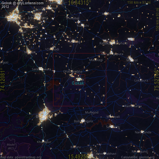
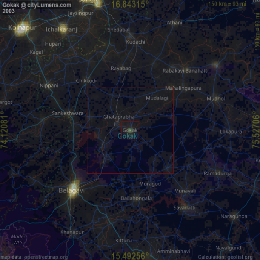
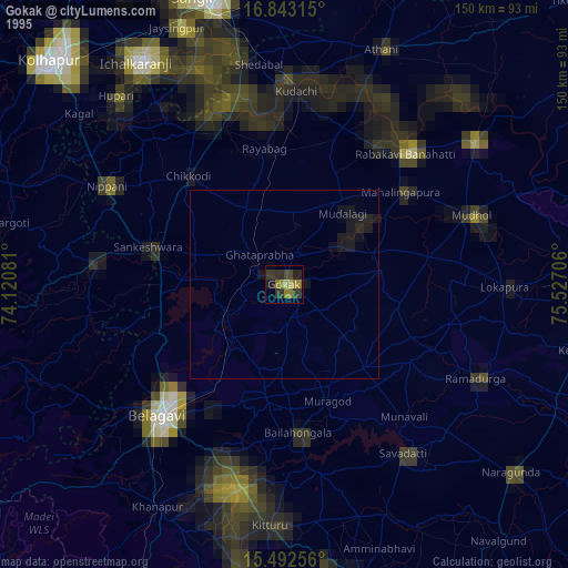
» NASA, Earths city lights 1995
» NASA city lights 2003
» Earth at Night: Flat Maps 2012, 2016