Raghunathpur night lights from space
Night Light of Raghunathpur (West Bengal) from space (India) Src. Average luminocity for 10x10km area is 38.0615% and for 50x50km: 29.9287%.
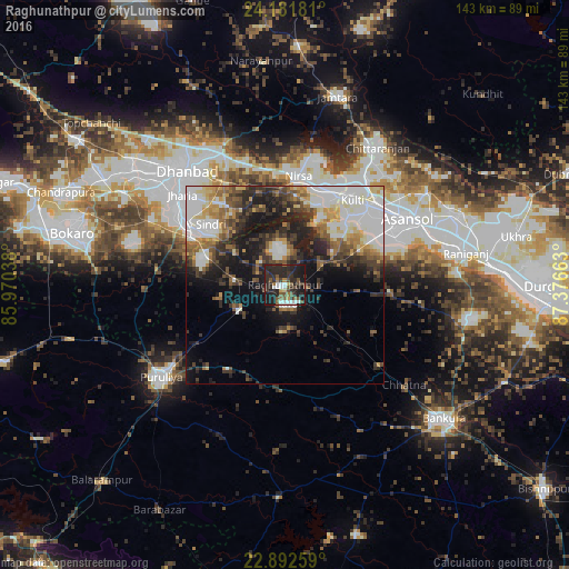
Analysis of Raghunathpur night lights 2016
Square area 10x10 km:
 4.56%
4.56%90-99
5.75%80-89
1.59%70-79
1.79%60-69
2.98%50-59
7.94%40-49
8.73%30-39
10.12%20-29
32.14%10-19
24.21%0-9
0.2%Square area 50x50 km:
7.21%90-99
6.08%80-89
3%70-79
2.53%60-69
3.37%50-59
4.06%40-49
4.13%30-39
5.01%20-29
8.01%10-19
12.59%0-9
44.01%Clear (daylight) street map image can be seen on geolist.org.
Map coordinates:
24° 10' 54.5" North, 85° 58' 13.4" East
23° 32' 19.6" North, 86° 40' 24.6" East
22° 53' 33.3" North, 87° 22' 35.9" East
Some cities around Raghunathpur sort by population:
• Kulti
27.6 km =17.1 mi,  38°
38°
• Jharia
34.6 km =21.5 mi,  310°
310°
• Pāthardih
28.4 km =17.6 mi,  299°
299°
• Jāmadoba
34.2 km =21.3 mi, 305°
• Lakhyabad
14.2 km =8.8 mi,  357°
357°
• Adra
4.8 km =3 mi,  167°
167°
• Nirsā
27.5 km =17.1 mi,  7°
7°
• Bhojudih
26.2 km =16.3 mi, 295°
1259049 (p: 22,802)
Sources (retrieved 2019-11-25):
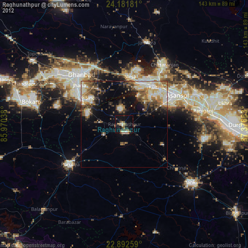
» Earth at Night: Flat Maps 2012, 2016