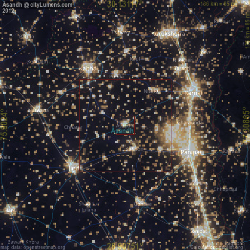
Āsandh night lights from space
Night Light of Āsandh (Haryana) from space (India) Src. Average luminocity for 10x10km area is 17.3977% and for 50x50km: 14.3011%.
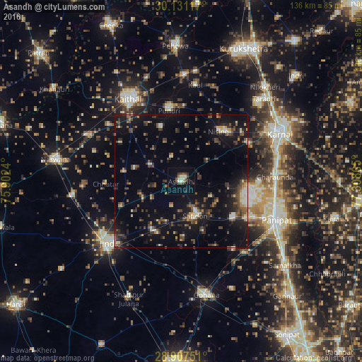
Analysis of Āsandh night lights 2016
Square area 10x10 km:
 0.95%
0.95%90-99
2.84%80-89
2.84%70-79
0.19%60-69
1.52%50-59
2.08%40-49
4.36%30-39
3.79%20-29
1.89%10-19
5.49%0-9
74.05%Square area 50x50 km:
0.68%90-99
1.4%80-89
1.45%70-79
1.14%60-69
1.11%50-59
2.34%40-49
3.54%30-39
3.89%20-29
4.43%10-19
12.75%0-9
67.28%Clear (daylight) street map image can be seen on geolist.org.
Map coordinates:
30° 7' 52.2" North, 75° 54' 8.6" East
29° 31' 16.3" North, 76° 36' 19.9" East
28° 54' 27" North, 77° 18' 31.1" East
Some cities around Āsandh sort by population:
• Pānīpat
38.1 km =23.7 mi,  112°
112°
• Karnāl
41.3 km =25.7 mi,  62°
62°
• Jīnd
36.2 km =22.5 mi,  230°
230°
• Kaithal
37 km =23 mi,  327°
327°
• Gharaunda
35.4 km =22 mi,  87°
87°
• Safidon
14.3 km =8.9 mi,  153°
153°
• Pūndri
27 km =16.8 mi,  350°
350°
• Bara Uchāna
41.8 km =26 mi,  261°
261°
1278320 (p: 25,323)
Sources (retrieved 2019-11-25):
» Earth at Night: Flat Maps 2012, 2016