Amalner night lights from space
Night Light of Amalner (Maharashtra) from space (India) Src. Average luminocity for 10x10km area is 16.871% and for 50x50km: 5.4897%.
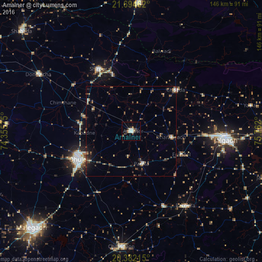
Analysis of Amalner night lights 2016
Square area 10x10 km:
 0.4%
0.4%90-99
5.95%80-89
2.18%70-79
0.2%60-69
1.39%50-59
1.79%40-49
1.79%30-39
3.17%20-29
3.77%10-19
4.17%0-9
75.2%Square area 50x50 km:
0.04%90-99
0.67%80-89
0.41%70-79
0.37%60-69
1.04%50-59
1.07%40-49
1.3%30-39
1.42%20-29
1.43%10-19
2.02%0-9
90.23%Clear (daylight) street map image can be seen on geolist.org.
Map coordinates:
21° 41' 40.6" North, 74° 21' 20.7" East
21° 2' 23.4" North, 75° 3' 31.9" East
20° 22' 55.7" North, 75° 45' 43.2" East
Some cities around Amalner sort by population:
• Jalgaon
52.8 km =32.8 mi,  94°
94°
• Dhūlia
33 km =20.5 mi,  242°
242°
• Shirpur
39 km =24.2 mi,  331°
331°
• Chopda
33.9 km =21.1 mi,  47°
47°
• Pāchora
51.5 km =32 mi,  143°
143°
• Parola
18.7 km =11.6 mi,  160°
160°
• Dharangaon
22.6 km =14 mi,  97°
97°
• Erandol
30.7 km =19.1 mi,  115°
115°
1278931 (p: 97,369)
Sources (retrieved 2019-11-25):
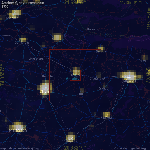
» NASA, Earths city lights 1995
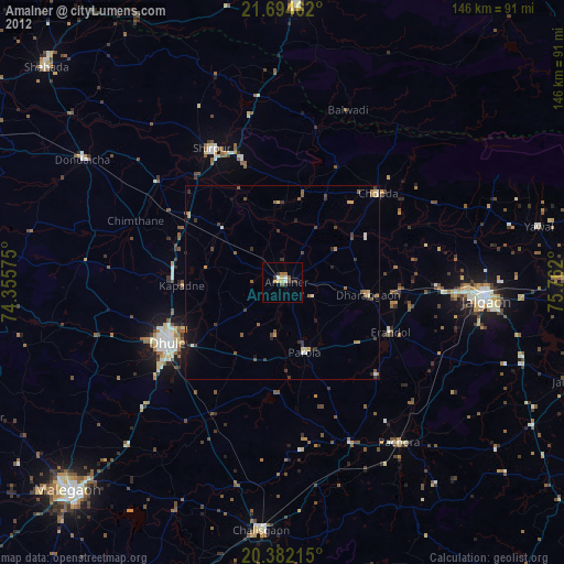
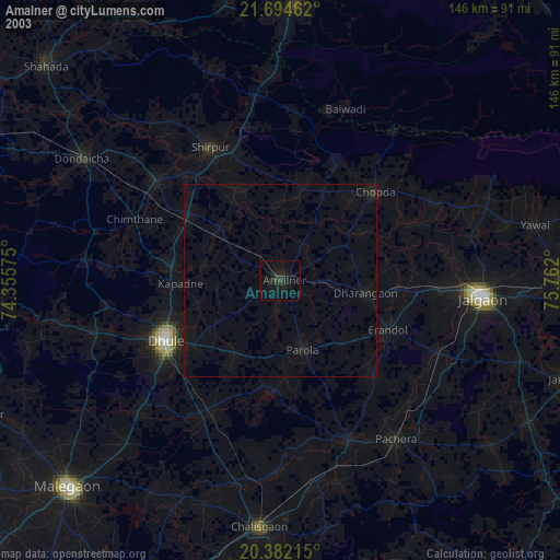
» NASA city lights 2003
» Earth at Night: Flat Maps 2012, 2016