Dharangaon night lights from space
Night Light of Dharangaon (Maharashtra) from space (India) Src. Average luminocity for 10x10km area is 10.0655% and for 50x50km: 6.558%.
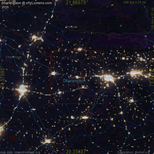
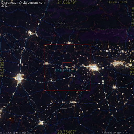
Analysis of Dharangaon night lights 2016
Square area 10x10 km:
 0%
0%90-99
1.79%80-89
0.6%70-79
0.79%60-69
3.57%50-59
1.19%40-49
1.19%30-39
0.79%20-29
2.38%10-19
0.79%0-9
86.9%Square area 50x50 km:
0.09%90-99
0.7%80-89
0.64%70-79
0.52%60-69
1%50-59
1.33%40-49
1.58%30-39
1.76%20-29
1.92%10-19
2.49%0-9
87.98%Clear (daylight) street map image can be seen on geolist.org.
Map coordinates:
21° 40' 0.4" North, 74° 34' 15.4" East
21° 0' 42.7" North, 75° 16' 26.7" East
20° 21' 14.7" North, 75° 58' 37.9" East
Some cities around Dharangaon sort by population:
• Jalgaon
30.3 km =18.8 mi,  91°
91°
• Dhūlia
53 km =32.9 mi,  256°
256°
• Amalner
22.6 km =14 mi,  277°
277°
• Chopda
26.1 km =16.2 mi,  5°
5°
• Pāchora
39.2 km =24.4 mi,  167°
167°
• Parola
21.7 km =13.5 mi,  227°
227°
• Yāval
47.2 km =29.3 mi,  68°
68°
• Erandol
11.4 km =7.1 mi,  151°
151°
1272874 (p: 33,718)
Sources (retrieved 2019-11-25):
» Earth at Night: Flat Maps 2012, 2016