Ābu Road night lights from space
Night Light of Ābu Road (Rajasthan) from space (India) Src. Average luminocity for 10x10km area is 39.7421% and for 50x50km: 5.7154%.
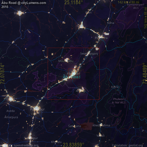
Analysis of Ābu Road night lights 2016
Square area 10x10 km:
 4.37%
4.37%90-99
11.9%80-89
4.76%70-79
0.6%60-69
5.16%50-59
10.32%40-49
1.39%30-39
1.79%20-29
11.11%10-19
39.68%0-9
8.93%Square area 50x50 km:
0.42%90-99
1.3%80-89
0.69%70-79
0.32%60-69
0.6%50-59
0.95%40-49
0.67%30-39
0.53%20-29
1.04%10-19
3.99%0-9
89.5%Clear (daylight) street map image can be seen on geolist.org.
Map coordinates:
25° 7' 6.2" North, 72° 4' 43.5" East
24° 28' 48.4" North, 72° 46' 54.7" East
23° 50' 18.9" North, 73° 29' 6" East
Some cities around Ābu Road sort by population:
• Pālanpur
48.9 km =30.4 mi,  225°
225°
• Dīsa
65.9 km =40.9 mi,  247°
247°
• Sirohi
45.9 km =28.5 mi,  8°
8°
• Khedbrahma
56.8 km =35.3 mi,  151°
151°
• Ābu
14.2 km =8.8 mi,  332°
332°
• Pindwāra
44.8 km =27.8 mi,  38°
38°
• Kherālu
68.2 km =42.4 mi,  194°
194°
• Kānodar
58.6 km =36.4 mi,  222°
222°
1279394 (p: 50,262)
Sources (retrieved 2019-11-25):
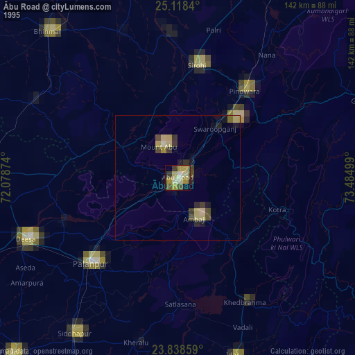
» NASA, Earths city lights 1995
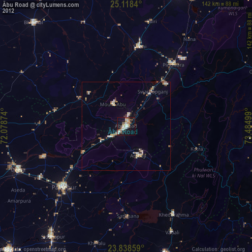
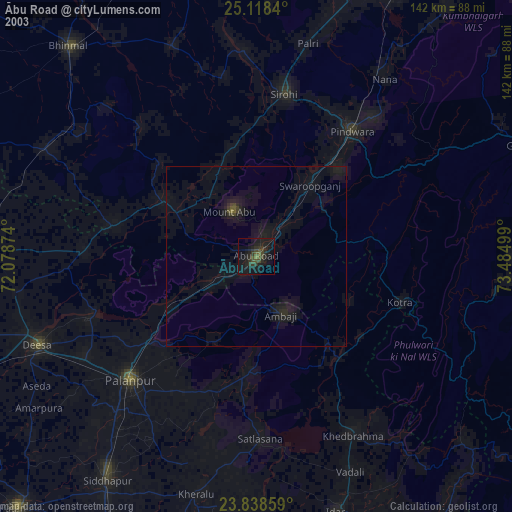
» NASA city lights 2003
» Earth at Night: Flat Maps 2012, 2016