Kherālu night lights from space
Night Light of Kherālu (Gujarat) from space (India) Src. Average luminocity for 10x10km area is 4.004% and for 50x50km: 3.3178%.
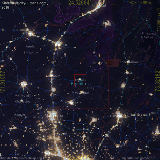
Analysis of Kherālu night lights 2016
Square area 10x10 km:
 0%
0%90-99
0.79%80-89
0.6%70-79
0.79%60-69
0.2%50-59
1.39%40-49
0.99%30-39
0%20-29
0.79%10-19
0%0-9
94.44%Square area 50x50 km:
0.11%90-99
0.44%80-89
0.26%70-79
0.35%60-69
0.47%50-59
0.66%40-49
0.85%30-39
0.4%20-29
0.54%10-19
1.88%0-9
94.04%Clear (daylight) street map image can be seen on geolist.org.
Map coordinates:
24° 31' 35.9" North, 71° 54' 56.1" East
23° 53' 7.2" North, 72° 37' 7.3" East
23° 14' 27.1" North, 73° 19' 18.6" East
Some cities around Kherālu sort by population:
• Pālanpur
36.7 km =22.8 mi,  330°
330°
• Visnagar
21.8 km =13.5 mi,  198°
198°
• Unjha
24.9 km =15.5 mi,  248°
248°
• Siddhapur
25.3 km =15.7 mi,  278°
278°
• Khedbrahma
46.3 km =28.8 mi,  69°
69°
• Vadnagar
11.2 km =7 mi,  169°
169°
• Vijāpur
38.3 km =23.8 mi,  159°
159°
• Kānodar
32.2 km =20 mi,  314°
314°
1266774 (p: 20,755)
Sources (retrieved 2019-11-25):
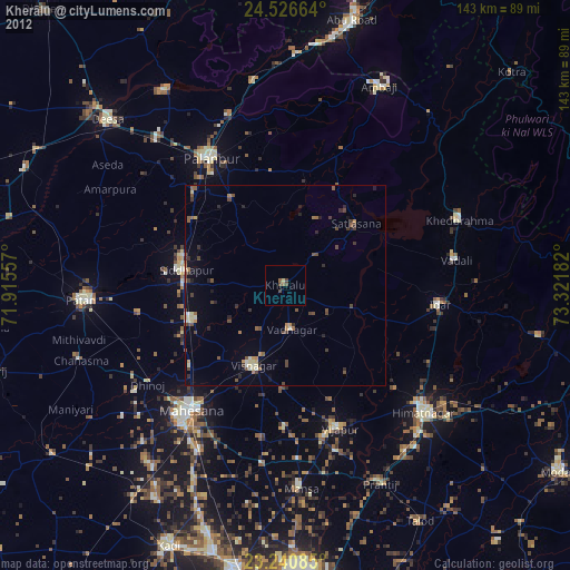
» Earth at Night: Flat Maps 2012, 2016