Tel Mond night lights from space
Night Light of Tel Mond (Central District) from space (Israel) Src. Average luminocity for 10x10km area is 92.1484% and for 50x50km: 54.5924%.
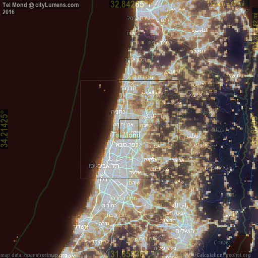
Analysis of Tel Mond night lights 2016
Square area 10x10 km:
 26.01%
90-99
32.05%80-89
36.26%70-79
5.49%60-69
0.18%50-59
0%40-49
0%30-39
0%20-29
0%10-19
0%0-9
0%Square area 50x50 km:
14.16%90-99
13.29%80-89
10.76%70-79
7.02%60-69
5.42%50-59
5.65%40-49
5.98%30-39
5.24%20-29
6.29%10-19
3.33%0-9
22.85%Clear (daylight) street map image can be seen on geolist.org.
Map coordinates:
32° 50' 33.5" North, 34° 12' 51.3" East
32° 14' 59.8" North, 34° 55' 2.5" East
31° 39' 12.1" North, 35° 37' 13.8" East
Some cities around Tel Mond sort by population:
• Kfar Saba
8.4 km =5.2 mi,  186°
186°
• Ra'anana
8.4 km =5.2 mi,  209°
209°
• Qalqīlyah, PS
8.4 km =5.2 mi,  143°
143°
• Kefar Yona
7.6 km =4.7 mi,  12°
12°
• Tirah
3.6 km =2.2 mi,  119°
119°
• Qalansuwa
7.1 km =4.4 mi,  56°
56°
• Even Yehuda
3.6 km =2.2 mi,  307°
307°
• Pardesiyya
6.3 km =3.9 mi,  352°
352°
293354 (p: 8,725)
Sources (retrieved 2019-11-25):
» Earth at Night: Flat Maps 2012, 2016