Shelomi night lights from space
Night Light of Shelomi (Northern District) from space (Israel) Src. Average luminocity for 10x10km area is 50.3736% and for 50x50km: 32.5947%.
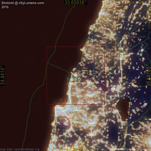
Analysis of Shelomi night lights 2016
Square area 10x10 km:
 3.3%
3.3%90-99
4.03%80-89
11.36%70-79
8.61%60-69
3.48%50-59
8.97%40-49
22.89%30-39
15.93%20-29
13.55%10-19
7.69%0-9
0.18%Square area 50x50 km:
3.23%90-99
3.91%80-89
7%70-79
4.73%60-69
6.24%50-59
7.02%40-49
7.21%30-39
5.59%20-29
6.37%10-19
9.45%0-9
39.25%Clear (daylight) street map image can be seen on geolist.org.
Map coordinates:
33° 39' 33.8" North, 34° 26' 29" East
33° 4' 19.8" North, 35° 8' 40.3" East
32° 28' 51.6" North, 35° 50' 51.5" East
Some cities around Shelomi sort by population:
• Nahariyya
8.3 km =5.2 mi,  211°
211°
• Acre
17.2 km =10.7 mi,  201°
201°
• En Nâqoûra, LB
5.1 km =3.2 mi,  354°
354°
• maalot Tarshīhā
12.9 km =8 mi,  118°
118°
• Judeida Makr
16 km =9.9 mi,  175°
175°
• Kfar Yasif
13.2 km =8.2 mi,  172°
172°
• Kefar Weradim
15.2 km =9.4 mi, 124°
• Ḥurfeish
20 km =12.4 mi,  107°
107°
293522 (p: 5,608)
Sources (retrieved 2019-11-25):
» Earth at Night: Flat Maps 2012, 2016