Kfar Yasif night lights from space
Night Light of Kfar Yasif (Northern District) from space (Israel) Src. Average luminocity for 10x10km area is 74.7308% and for 50x50km: 46.1172%.
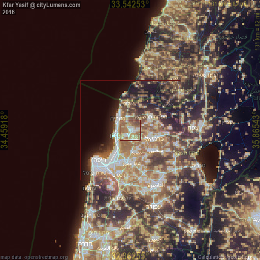
Analysis of Kfar Yasif night lights 2016
Square area 10x10 km:
 11.54%
90-99
12.82%80-89
17.58%70-79
10.81%60-69
28.57%50-59
13.55%40-49
5.13%30-39
0%20-29
0%10-19
0%0-9
0%Square area 50x50 km:
8.05%90-99
7.4%80-89
9.26%70-79
6.78%60-69
8.64%50-59
7.67%40-49
6.57%30-39
6.2%20-29
6.51%10-19
9.81%0-9
23.12%Clear (daylight) street map image can be seen on geolist.org.
Map coordinates:
33° 32' 33.1" North, 34° 27' 33" East
32° 57' 16.2" North, 35° 9' 44.3" East
32° 21' 45.2" North, 35° 51' 55.5" East
Some cities around Kfar Yasif sort by population:
• Nahariyya
8.5 km =5.3 mi,  315°
315°
• Acre
8.5 km =5.3 mi,  249°
249°
• Tamra
11.8 km =7.3 mi,  163°
163°
• maalot Tarshīhā
11.9 km =7.4 mi,  54°
54°
• Judeida Makr
3 km =1.9 mi,  189°
189°
• Kābūl
10.6 km =6.6 mi,  154°
154°
• Shelomi
13.2 km =8.2 mi,  352°
352°
• Kefar Weradim
11.6 km =7.2 mi,  67°
67°
294600 (p: 9,587)
Sources (retrieved 2019-11-25):
» Earth at Night: Flat Maps 2012, 2016