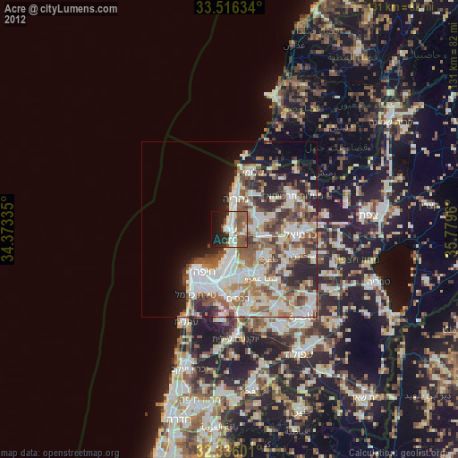
Acre night lights from space
Night Light of Acre (Northern District) from space (Israel) Src. Average luminocity for 10x10km area is 54.7015% and for 50x50km: 40.7996%.
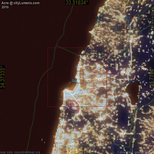
Analysis of Acre night lights 2016
Square area 10x10 km:
 10.26%
90-99
10.62%80-89
9.34%70-79
5.31%60-69
17.95%50-59
2.93%40-49
4.21%30-39
3.66%20-29
14.65%10-19
15.57%0-9
5.49%Square area 50x50 km:
8.02%90-99
7.28%80-89
8.32%70-79
6.09%60-69
8.21%50-59
5.57%40-49
4.43%30-39
4.4%20-29
4.42%10-19
7.25%0-9
36%Clear (daylight) street map image can be seen on geolist.org.
Map coordinates:
33° 30' 58.8" North, 34° 22' 24.1" East
32° 55' 41.3" North, 35° 4' 35.3" East
32° 20' 9.6" North, 35° 46' 46.6" East
Some cities around Acre sort by population:
• Nahariyya
9.2 km =5.7 mi,  12°
12°
• Qiryat Ata
13.4 km =8.3 mi,  165°
165°
• Qiryat Moẕqin
10.1 km =6.3 mi,  179°
179°
• Qiryat Yam
8.7 km =5.4 mi, 184°
• Qiryat Bialik
11.2 km =7 mi, 175°
• Tamra
14.1 km =8.8 mi,  126°
126°
• Judeida Makr
7.5 km =4.7 mi,  89°
89°
• Kfar Yasif
8.5 km =5.3 mi,  69°
69°
295721 (p: 45,603)
Sources (retrieved 2019-11-25):
» Earth at Night: Flat Maps 2012, 2016