Beersheba night lights from space
Night Light of Beersheba (Southern District) from space (Israel) Src. Average luminocity for 10x10km area is 84.4011% and for 50x50km: 29.9328%.
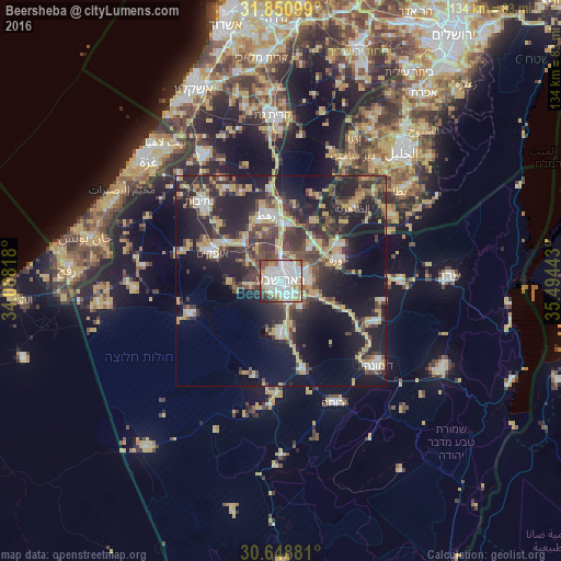

Analysis of Beersheba night lights 2016
Square area 10x10 km:
 38.64%
90-99
23.99%80-89
4.21%70-79
10.62%60-69
3.3%50-59
6.04%40-49
8.61%30-39
2.01%20-29
2.38%10-19
0.18%0-9
0%Square area 50x50 km:
3.95%90-99
3.49%80-89
3.49%70-79
6.73%60-69
1.67%50-59
2.6%40-49
6.92%30-39
6.87%20-29
11.69%10-19
19.17%0-9
33.42%Clear (daylight) street map image can be seen on geolist.org.
Map coordinates:
31° 51' 3.6" North, 34° 5' 17.4" East
31° 15' 6.5" North, 34° 47' 28.7" East
30° 38' 55.7" North, 35° 29' 39.9" East
Some cities around Beersheba sort by population:
• Dimona
30.5 km =19 mi,  131°
131°
• Az̧ Z̧āhirīyah, PS
24.6 km =15.3 mi,  44°
44°
• Netivot
27 km =16.8 mi,  314°
314°
• Ofaqim
17.7 km =11 mi,  293°
293°
• Rahat
16.3 km =10.1 mi,  348°
348°
• As Samū‘, PS
30.7 km =19.1 mi,  58°
58°
• Yeroẖam
32.2 km =20 mi,  155°
155°
• Lehavim
13.7 km =8.5 mi,  9°
9°
295530 (p: 186,600)
Sources (retrieved 2019-11-25):
» NASA, Earths city lights 1995
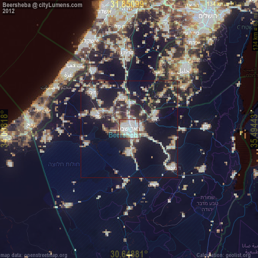
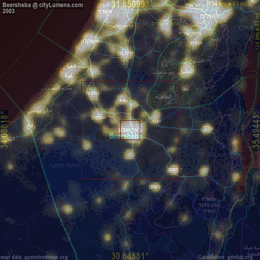
» NASA city lights 2003
» Earth at Night: Flat Maps 2012, 2016