Yeroẖam night lights from space
Night Light of Yeroẖam (Southern District) from space (Israel) Src. Average luminocity for 10x10km area is 16.0604% and for 50x50km: 10.4783%.
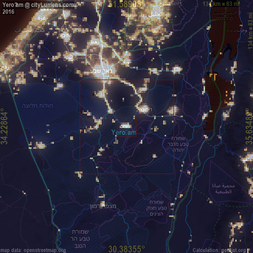
Analysis of Yeroẖam night lights 2016
Square area 10x10 km:
 3.3%
3.3%90-99
2.56%80-89
1.1%70-79
1.83%60-69
0%50-59
1.28%40-49
3.66%30-39
1.65%20-29
0.73%10-19
4.03%0-9
79.85%Square area 50x50 km:
1.02%90-99
0.83%80-89
0.97%70-79
3.01%60-69
0.29%50-59
0.42%40-49
2.23%30-39
1.89%20-29
2.6%10-19
10.12%0-9
76.61%Clear (daylight) street map image can be seen on geolist.org.
Map coordinates:
31° 35' 20.7" North, 34° 13' 43.1" East
30° 59' 17.6" North, 34° 55' 54.3" East
30° 23' 0.8" North, 35° 38' 5.6" East
Some cities around Yeroẖam sort by population:
• Beersheba
32.2 km =20 mi,  335°
335°
• Dimona
13.3 km =8.3 mi,  46°
46°
• Az̧ Z̧āhirīyah, PS
47 km =29.2 mi,  4°
4°
• Ofaqim
46.8 km =29.1 mi,  320°
320°
• Arad
40.3 km =25 mi,  41°
41°
• Rahat
48.2 km =30 mi, 339°
• As Samū‘, PS
47.2 km =29.3 mi,  15°
15°
• Lehavim
44.2 km =27.5 mi,  345°
345°
293203 (p: 8,631)
Sources (retrieved 2019-11-25):
» Earth at Night: Flat Maps 2012, 2016