Ringsend night lights from space
Night Light of Ringsend (Leinster) from space (Ireland) Src. Average luminocity for 10x10km area is 87.9596% and for 50x50km: 22.9867%.
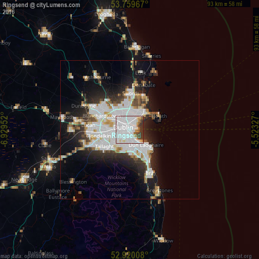
Analysis of Ringsend night lights 2016
Square area 10x10 km:
 59.47%
90-99
16.16%80-89
2.78%70-79
3.41%60-69
1.77%50-59
2.9%40-49
4.29%30-39
8.08%20-29
1.14%10-19
0%0-9
0%Square area 50x50 km:
8.07%90-99
5.27%80-89
1.65%70-79
1.7%60-69
1.59%50-59
1.56%40-49
2.12%30-39
2.54%20-29
5.11%10-19
9.34%0-9
61.05%Clear (daylight) street map image can be seen on geolist.org.
Map coordinates:
53° 45' 34.8" North, 6° 55' 46.3" West
53° 20' 31" North, 6° 13' 35" West
52° 55' 12.3" North, 5° 31' 23.8" West
Some cities around Ringsend sort by population:
• Dublin
1.8 km =1.1 mi,  236°
236°
• Rathmines
3.4 km =2.1 mi,  225°
225°
• Marino
3.2 km =2 mi,  348°
348°
• Donnybrook
3.1 km =1.9 mi,  175°
175°
• Sandymount
1.6 km =1 mi,  169°
169°
• Donnycarney
3.7 km =2.3 mi,  17°
17°
• Killester
3.8 km =2.4 mi, 22°
• Dollymount
4 km =2.5 mi,  50°
50°
2961816 (p: 8,202)
Sources (retrieved 2019-11-25):
» Earth at Night: Flat Maps 2012, 2016