Killester night lights from space
Night Light of Killester (Leinster) from space (Ireland) Src. Average luminocity for 10x10km area is 82.8347% and for 50x50km: 22.7635%.
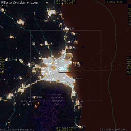
Analysis of Killester night lights 2016
Square area 10x10 km:
 54.5%
54.5%90-99
14.42%80-89
2.12%70-79
4.1%60-69
3.44%50-59
3.17%40-49
2.25%30-39
6.48%20-29
8.2%10-19
1.32%0-9
0%Square area 50x50 km:
8.09%90-99
5.2%80-89
1.64%70-79
1.58%60-69
1.61%50-59
1.44%40-49
2.07%30-39
2.59%20-29
5.16%10-19
9.42%0-9
61.19%Clear (daylight) street map image can be seen on geolist.org.
Map coordinates:
53° 47' 26.3" North, 6° 54' 26.7" West
53° 22' 23.6" North, 6° 12' 15.5" West
52° 57' 6" North, 5° 30' 4.2" West
Some cities around Killester sort by population:
• Marino
2.2 km =1.4 mi,  261°
261°
• Beaumont
2.2 km =1.4 mi,  315°
315°
• Ringsend
3.8 km =2.4 mi,  202°
202°
• Donnycarney
0.4 km =0.2 mi,  274°
274°
• Raheny
2.2 km =1.4 mi,  46°
46°
• Darndale
3.1 km =1.9 mi,  19°
19°
• Artane
1.7 km =1.1 mi,  337°
337°
• Dollymount
1.8 km =1.1 mi,  120°
120°
7869996 (p: 5,099)
Sources (retrieved 2019-11-25):
» Earth at Night: Flat Maps 2012, 2016