Sandymount night lights from space
Night Light of Sandymount (Leinster) from space (Ireland) Src. Average luminocity for 10x10km area is 87.0076% and for 50x50km: 23.1132%.
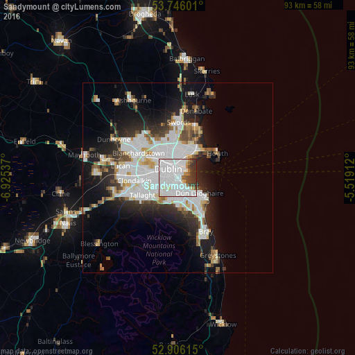
Analysis of Sandymount night lights 2016
Square area 10x10 km:
 56.57%
90-99
19.07%80-89
2.27%70-79
2.4%60-69
1.77%50-59
2.53%40-49
4.29%30-39
8.33%20-29
2.78%10-19
0%0-9
0%Square area 50x50 km:
8.15%90-99
5.3%80-89
1.66%70-79
1.65%60-69
1.62%50-59
1.57%40-49
2.16%30-39
2.59%20-29
5.19%10-19
9.28%0-9
60.82%Clear (daylight) street map image can be seen on geolist.org.
Map coordinates:
53° 44' 45.6" North, 6° 55' 31.3" West
53° 19' 41.3" North, 6° 13' 20.1" West
52° 54' 22.1" North, 5° 31' 8.8" West
Some cities around Sandymount sort by population:
• Dublin
1.9 km =1.2 mi,  287°
287°
• Rathmines
2.9 km =1.8 mi,  252°
252°
• Donnybrook
1.6 km =1 mi,  181°
181°
• Blackrock
4.2 km =2.6 mi,  135°
135°
• Rathgar
3.8 km =2.4 mi, 246°
• Ringsend
1.6 km =1 mi,  349°
349°
• Mount Merrion
3.2 km =2 mi,  171°
171°
• Booterstown
3 km =1.9 mi,  150°
150°
2961589 (p: 8,967)
Sources (retrieved 2019-11-25):
» Earth at Night: Flat Maps 2012, 2016