Ballina night lights from space
Night Light of Ballina (Connaught) from space (Ireland) Src. Average luminocity for 10x10km area is 8.428% and for 50x50km: 0.557%.
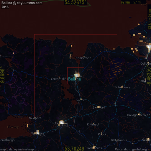
Analysis of Ballina night lights 2016
Square area 10x10 km:
 1.39%
1.39%90-99
0.63%80-89
1.01%70-79
0.63%60-69
1.64%50-59
1.77%40-49
1.26%30-39
0.76%20-29
1.14%10-19
0.38%0-9
89.39%Square area 50x50 km:
0.06%90-99
0.03%80-89
0.09%70-79
0.08%60-69
0.07%50-59
0.13%40-49
0.09%30-39
0.12%20-29
0.13%10-19
0.07%0-9
99.15%Clear (daylight) street map image can be seen on geolist.org.
Map coordinates:
54° 31' 36.3" North, 9° 52' 11.3" West
54° 7' 0" North, 9° 10' 0" West
53° 42' 9" North, 8° 27' 48.8" West
Some cities around Ballina sort by population:
• Gaillimh
94.2 km =58.5 mi,  175°
175°
• Sligo
48.4 km =30.1 mi,  69°
69°
• Enniskillen, GB
102.4 km =63.6 mi,  75°
75°
• Castlebar
30.9 km =19.2 mi,  196°
196°
• Longford
99.6 km =61.9 mi,  115°
115°
• Westport
42 km =26.1 mi,  213°
213°
• Tuam
69.9 km =43.4 mi,  162°
162°
• Roscommon
83.9 km =52.1 mi,  129°
129°
2966778 (p: 10,087)
Sources (retrieved 2019-11-25):
» Earth at Night: Flat Maps 2012, 2016