Sumbawa Besar night lights from space
Night Light of Sumbawa Besar (West Nusa Tenggara) from space (Indonesia) Src. Average luminocity for 10x10km area is 28.0331% and for 50x50km: 1.5249%.
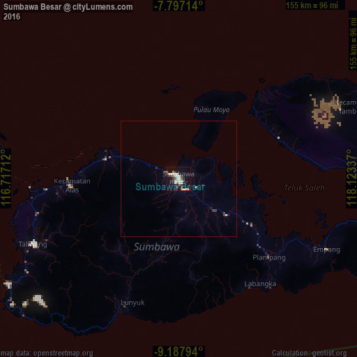

Analysis of Sumbawa Besar night lights 2016
Square area 10x10 km:
 2.89%
2.89%90-99
8.26%80-89
3.72%70-79
2.89%60-69
0.21%50-59
4.55%40-49
3.1%30-39
4.55%20-29
2.48%10-19
26.86%0-9
40.5%Square area 50x50 km:
0.13%90-99
0.35%80-89
0.18%70-79
0.14%60-69
0.03%50-59
0.19%40-49
0.18%30-39
0.3%20-29
0.24%10-19
1.24%0-9
97.03%Clear (daylight) street map image can be seen on geolist.org.
Map coordinates:
7° 47' 49.7" South, 116° 43' 1.6" East
8° 29' 35.4" South, 117° 25' 12.9" East
9° 11' 16.6" South, 118° 7' 24.1" East
Some cities around Sumbawa Besar sort by population:
• Mataram
143.7 km =89.3 mi,  265°
265°
• Bima
143.7 km =89.3 mi,  88°
88°
• Dompu
114.8 km =71.3 mi, 92°
• Praya
128.6 km =79.9 mi,  259°
259°
• Amlapura city
199.6 km =124 mi, 271°
• Amlapura
198.4 km =123.3 mi, 271°
• Lembar
150.2 km =93.3 mi, 260°
• Labuan Lombok
82.9 km =51.5 mi, 269°
1626185 (p: 52,654)
Sources (retrieved 2019-11-25):
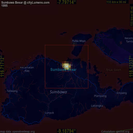
» NASA, Earths city lights 1995
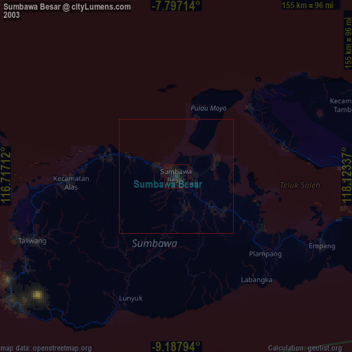
» NASA city lights 2003
» Earth at Night: Flat Maps 2012, 2016