Mataram night lights from space
Night Light of Mataram (West Nusa Tenggara) from space (Indonesia) Src. Average luminocity for 10x10km area is 88.8574% and for 50x50km: 15.3364%.
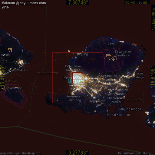

Analysis of Mataram night lights 2016
Square area 10x10 km:
 24.17%
90-99
39.05%80-89
22.31%70-79
5.79%60-69
2.89%50-59
0.83%40-49
2.48%30-39
0.62%20-29
1.86%10-19
0%0-9
0%Square area 50x50 km:
1.18%90-99
3.53%80-89
2.18%70-79
1.46%60-69
1.03%50-59
2.05%40-49
3.64%30-39
3.84%20-29
5.85%10-19
7.73%0-9
67.52%Clear (daylight) street map image can be seen on geolist.org.
Map coordinates:
7° 53' 14.9" South, 115° 24' 48.8" East
8° 34' 60" South, 116° 7' 0" East
9° 16' 40.5" South, 116° 49' 11.3" East
Some cities around Mataram sort by population:
• Praya
21.7 km =13.5 mi,  128°
128°
• Amlapura city
58.1 km =36.1 mi,  284°
284°
• Amlapura
56.9 km =35.4 mi,  285°
285°
• Ubud
94 km =58.4 mi,  274°
274°
• Klungkung
79 km =49.1 mi, 274°
• Bedugul
59.5 km =37 mi, 284°
• Labuan Lombok
61.2 km =38 mi,  81°
81°
• Lembar
16.6 km =10.3 mi,  196°
196°
1635882 (p: 318,674)
Sources (retrieved 2019-11-25):
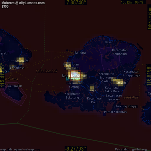
» NASA, Earths city lights 1995
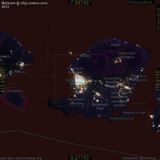
» NASA city lights 2003
» Earth at Night: Flat Maps 2012, 2016