Praya night lights from space
Night Light of Praya (West Nusa Tenggara) from space (Indonesia) Src. Average luminocity for 10x10km area is 37.6116% and for 50x50km: 18.1131%.
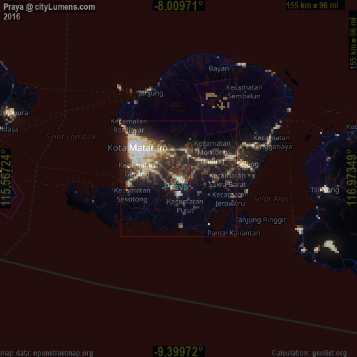
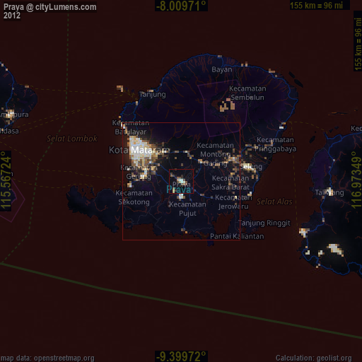
Analysis of Praya night lights 2016
Square area 10x10 km:
 0.83%
0.83%90-99
4.34%80-89
5.79%70-79
3.93%60-69
2.48%50-59
4.75%40-49
10.95%30-39
20.25%20-29
22.31%10-19
22.73%0-9
1.65%Square area 50x50 km:
1.23%90-99
3.67%80-89
2.66%70-79
1.55%60-69
1.09%50-59
2.22%40-49
4.57%30-39
5.39%20-29
7.61%10-19
11.41%0-9
58.6%Clear (daylight) street map image can be seen on geolist.org.
Map coordinates:
8° 0' 35" South, 115° 34' 2.1" East
8° 42' 19.3" South, 116° 16' 13.3" East
9° 23' 59" South, 116° 58' 24.6" East
Some cities around Praya sort by population:
• Mataram
21.7 km =13.5 mi,  308°
308°
• Amlapura city
78.4 km =48.7 mi,  291°
291°
• Amlapura
77.3 km =48 mi, 291°
• Ubud
112.6 km =70 mi,  281°
281°
• Klungkung
97.6 km =60.6 mi, 281°
• Bedugul
79.7 km =49.5 mi, 290°
• Labuan Lombok
49.2 km =30.6 mi,  62°
62°
• Lembar
21.7 km =13.5 mi,  263°
263°
1630662 (p: 35,183)
Sources (retrieved 2019-11-25):
» Earth at Night: Flat Maps 2012, 2016