Sokaraja night lights from space
Night Light of Sokaraja (Central Java) from space (Indonesia) Src. Average luminocity for 10x10km area is 38.3983% and for 50x50km: 8.27%.
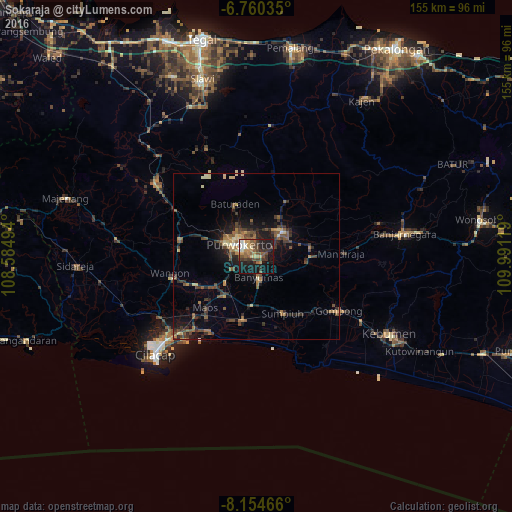
Analysis of Sokaraja night lights 2016
Square area 10x10 km:
 2.81%
2.81%90-99
4.11%80-89
2.6%70-79
9.52%60-69
3.46%50-59
9.31%40-49
10.17%30-39
8.66%20-29
11.69%10-19
29.87%0-9
7.79%Square area 50x50 km:
0.23%90-99
0.42%80-89
1.06%70-79
0.93%60-69
1.21%50-59
2.05%40-49
2.17%30-39
1.68%20-29
2.78%10-19
5.82%0-9
81.66%Clear (daylight) street map image can be seen on geolist.org.
Map coordinates:
6° 45' 37.3" South, 108° 35' 5.8" East
7° 27' 29" South, 109° 17' 17" East
8° 9' 16.8" South, 109° 59' 28.3" East
Some cities around Sokaraja sort by population:
• Purwokerto
7.2 km =4.5 mi,  304°
304°
• Purbalingga
11.4 km =7.1 mi,  47°
47°
• Banyumas
6.3 km =3.9 mi,  173°
173°
• Baturaden
19.3 km =12 mi,  335°
335°
• Wangon
26.6 km =16.5 mi,  255°
255°
• Gombong
29.9 km =18.6 mi,  123°
123°
• Randudongkal
40.2 km =25 mi,  5°
5°
• Kroya
20 km =12.4 mi,  193°
193°
1626312 (p: 66,482)
Sources (retrieved 2019-11-25):
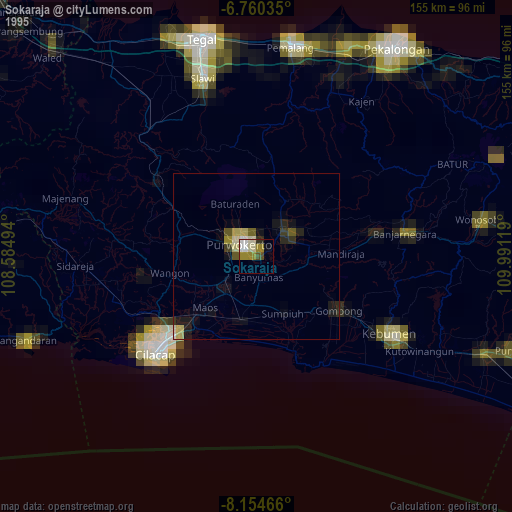
» NASA, Earths city lights 1995
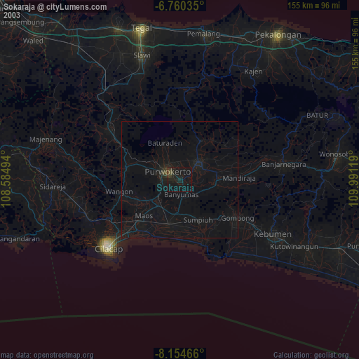
» NASA city lights 2003
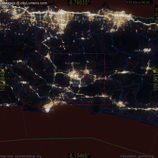
» Earth at Night: Flat Maps 2012, 2016