Purwokerto night lights from space
Night Light of Purwokerto (Central Java) from space (Indonesia) Src. Average luminocity for 10x10km area is 57.8766% and for 50x50km: 8.2926%.
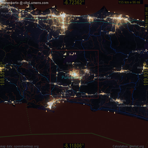
Analysis of Purwokerto night lights 2016
Square area 10x10 km:
 4.76%
4.76%90-99
6.93%80-89
11.26%70-79
12.12%60-69
13.64%50-59
16.02%40-49
9.96%30-39
4.98%20-29
8.87%10-19
11.04%0-9
0.43%Square area 50x50 km:
0.21%90-99
0.42%80-89
1.2%70-79
0.89%60-69
1.05%50-59
2.05%40-49
2.01%30-39
1.63%20-29
2.78%10-19
5.94%0-9
81.81%Clear (daylight) street map image can be seen on geolist.org.
Map coordinates:
6° 43' 25" South, 108° 31' 52.8" East
7° 25' 17" South, 109° 14' 4" East
8° 7' 5" South, 109° 56' 15.3" East
Some cities around Purwokerto sort by population:
• Sokaraja
7.2 km =4.5 mi,  124°
124°
• Purbalingga
14.7 km =9.1 mi,  75°
75°
• Banyumas
12.2 km =7.6 mi,  147°
147°
• Baturaden
13.6 km =8.5 mi,  351°
351°
• Wangon
22.5 km =14 mi,  242°
242°
• Gombong
37.1 km =23.1 mi, 123°
• Randudongkal
37.3 km =23.2 mi,  15°
15°
• Kroya
23.6 km =14.7 mi,  176°
176°
1630328 (p: 217,222)
Sources (retrieved 2019-11-25):
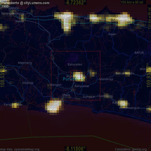
» NASA, Earths city lights 1995
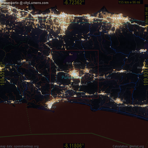
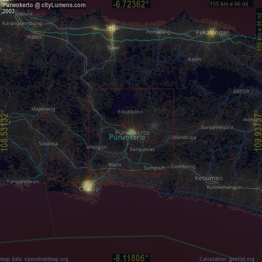
» NASA city lights 2003
» Earth at Night: Flat Maps 2012, 2016