Purbalingga night lights from space
Night Light of Purbalingga (Central Java) from space (Indonesia) Src. Average luminocity for 10x10km area is 22.5087% and for 50x50km: 6.9375%.
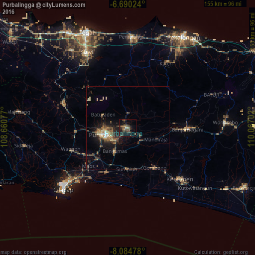
Analysis of Purbalingga night lights 2016
Square area 10x10 km:
 0.65%
0.65%90-99
0.22%80-89
2.6%70-79
2.16%60-69
0.43%50-59
10.39%40-49
4.76%30-39
9.09%20-29
9.31%10-19
15.37%0-9
45.02%Square area 50x50 km:
0.21%90-99
0.4%80-89
1.03%70-79
0.86%60-69
0.92%50-59
1.67%40-49
1.59%30-39
1.39%20-29
2.21%10-19
5%0-9
84.72%Clear (daylight) street map image can be seen on geolist.org.
Map coordinates:
6° 41' 24.9" South, 108° 39' 38.8" East
7° 23' 17" South, 109° 21' 50" East
8° 5' 5.2" South, 110° 4' 1.3" East
Some cities around Purbalingga sort by population:
• Purwokerto
14.7 km =9.1 mi,  255°
255°
• Sokaraja
11.4 km =7.1 mi,  227°
227°
• Banyumas
16 km =9.9 mi,  208°
208°
• Baturaden
19 km =11.8 mi,  301°
301°
• Wangon
37 km =23 mi,  247°
247°
• Gombong
29.5 km =18.3 mi,  145°
145°
• Randudongkal
32.5 km =20.2 mi,  352°
352°
• Kroya
30.2 km =18.8 mi, 205°
1630366 (p: 56,903)
Sources (retrieved 2019-11-25):
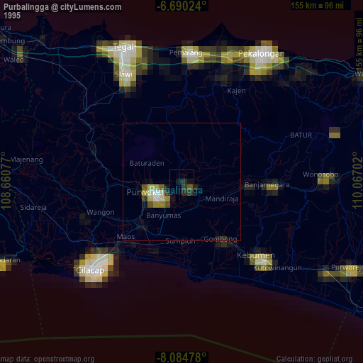
» NASA, Earths city lights 1995
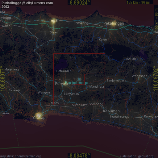
» NASA city lights 2003
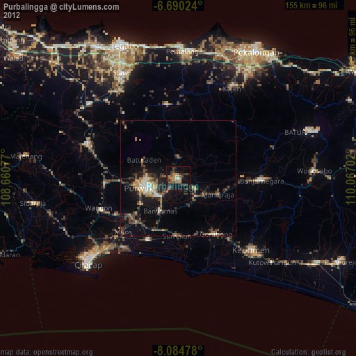
» Earth at Night: Flat Maps 2012, 2016