Ruteng night lights from space
Night Light of Ruteng (East Nusa Tenggara) from space (Indonesia) Src. Average luminocity for 10x10km area is 9.4236% and for 50x50km: 0.4468%.
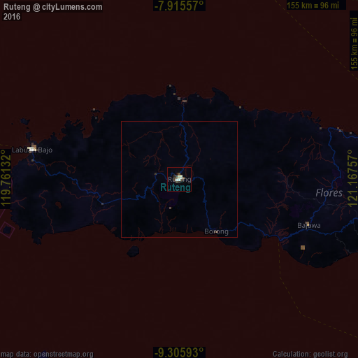
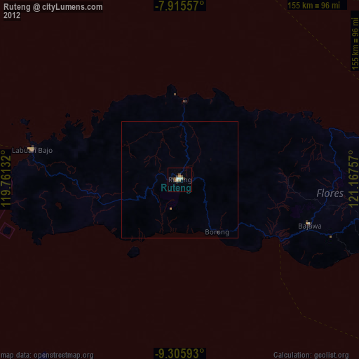
Analysis of Ruteng night lights 2016
Square area 10x10 km:
 0.62%
0.62%90-99
2.69%80-89
1.65%70-79
0%60-69
0%50-59
0%40-49
3.72%30-39
2.89%20-29
1.65%10-19
0.83%0-9
85.95%Square area 50x50 km:
0.03%90-99
0.11%80-89
0.07%70-79
0%60-69
0%50-59
0%40-49
0.2%30-39
0.17%20-29
0.1%10-19
0.03%0-9
99.29%Clear (daylight) street map image can be seen on geolist.org.
Map coordinates:
7° 54' 56.1" South, 119° 45' 40.8" East
8° 36' 41" South, 120° 27' 52" East
9° 18' 21.3" South, 121° 10' 3.3" East
Some cities around Ruteng sort by population:
• Kupang
385.9 km =239.8 mi,  116°
116°
• Labuan Bajo
64.7 km =40.2 mi,  281°
281°
• Ende
134.1 km =83.3 mi,  101°
101°
• Bima
191.8 km =119.2 mi, 275°
• Sumbawa Besar
335 km =208.2 mi,  272°
272°
• Dompu
220.2 km =136.8 mi, 272°
• Waingapu
118.3 km =73.5 mi,  190°
190°
• Maumere
192 km =119.3 mi,  90°
90°
1629380 (p: 34,569)
Sources (retrieved 2019-11-25):
» Earth at Night: Flat Maps 2012, 2016