Adiwerna night lights from space
Night Light of Adiwerna (Central Java) from space (Indonesia) Src. Average luminocity for 10x10km area is 58.8983% and for 50x50km: 12.5003%.
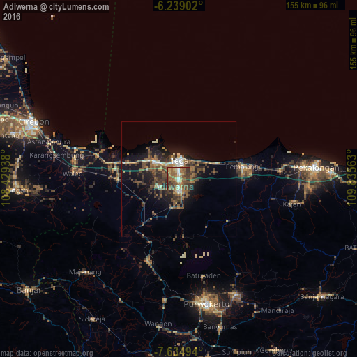
Analysis of Adiwerna night lights 2016
Square area 10x10 km:
 2.16%
2.16%90-99
7.14%80-89
8.01%70-79
8.87%60-69
18.4%50-59
22.73%40-49
15.58%30-39
13.85%20-29
3.25%10-19
0%0-9
0%Square area 50x50 km:
0.67%90-99
1.25%80-89
1.18%70-79
1.1%60-69
2.33%50-59
3.04%40-49
3.41%30-39
3.27%20-29
3.9%10-19
8.45%0-9
71.41%Clear (daylight) street map image can be seen on geolist.org.
Map coordinates:
6° 14' 20.5" South, 108° 25' 45.8" East
6° 56' 15" South, 109° 7' 57" East
7° 38' 5.8" South, 109° 50' 8.3" East
Some cities around Adiwerna sort by population:
• Tegal
7.6 km =4.7 mi,  6°
6°
• Dukuhturi
6.8 km =4.2 mi,  307°
307°
• Tarub
3.8 km =2.4 mi,  82°
82°
• Slawi
5 km =3.1 mi,  169°
169°
• Lebaksiu
12.5 km =7.8 mi, 174°
• Balapulang
12.8 km =8 mi,  195°
195°
• Margasari
22.1 km =13.7 mi,  215°
215°
• Bulakamba
20.7 km =12.9 mi,  289°
289°
1651887 (p: 134,188)
Sources (retrieved 2019-11-25):
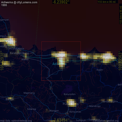
» NASA, Earths city lights 1995
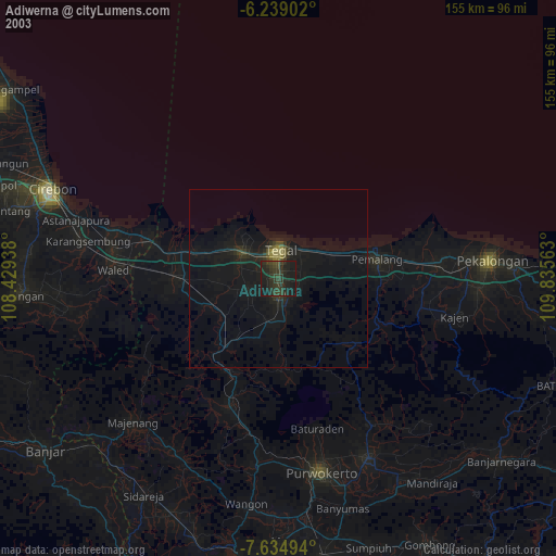
» NASA city lights 2003
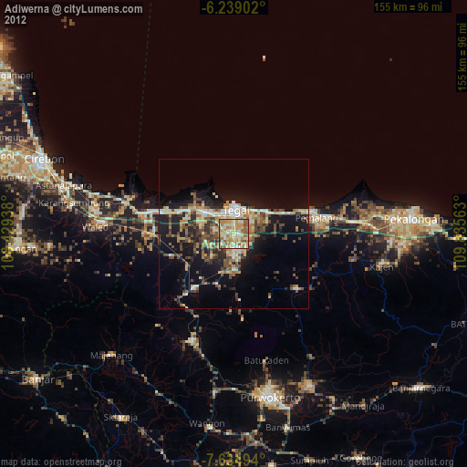
» Earth at Night: Flat Maps 2012, 2016