Jayapura night lights from space
Night Light of Jayapura (Papua) from space (Indonesia) Src. Average luminocity for 10x10km area is 37.7511% and for 50x50km: 4.5638%.
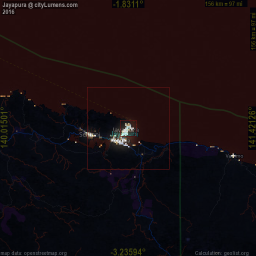
Analysis of Jayapura night lights 2016
Square area 10x10 km:
 11.9%
11.9%90-99
10.17%80-89
5.84%70-79
0.22%60-69
0%50-59
0.87%40-49
0.87%30-39
1.73%20-29
16.02%10-19
31.82%0-9
20.56%Square area 50x50 km:
1.04%90-99
1.19%80-89
0.49%70-79
0.16%60-69
0.03%50-59
0.1%40-49
0.37%30-39
0.46%20-29
1.56%10-19
3.98%0-9
90.63%Clear (daylight) street map image can be seen on geolist.org.
Map coordinates:
1° 49' 52" South, 140° 0' 54" East
2° 32' 1.4" South, 140° 43' 5.3" East
3° 14' 9.4" South, 141° 25' 16.5" East
Some cities around Jayapura sort by population:
• Abepura
11.8 km =7.3 mi,  233°
233°
• Mendi, PG
517.2 km =321.4 mi,  140°
140°
• Wewak, PG
342.7 km =212.9 mi,  109°
109°
• Kiunga, PG
404 km =251 mi,  170°
170°
• Vanimo, PG
67 km =41.6 mi,  104°
104°
• Tari, PG
443.4 km =275.5 mi,  146°
146°
• Aitape, PG
193.1 km =120 mi, 110°
• Wabag, PG
468.1 km =290.9 mi,  134°
134°
2082600 (p: 134,895)
Sources (retrieved 2019-11-25):
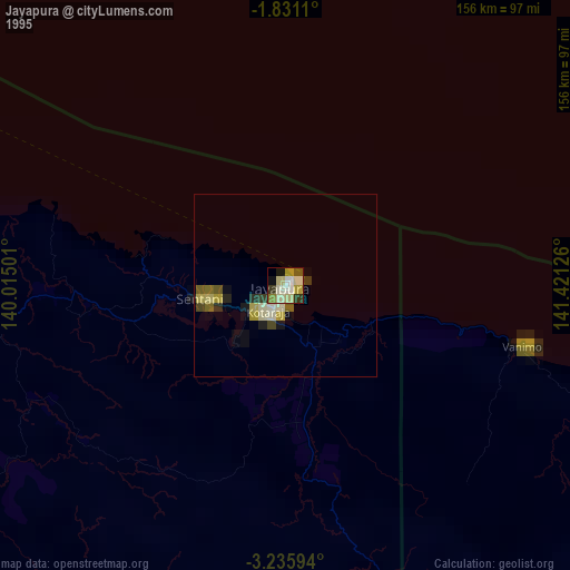
» NASA, Earths city lights 1995
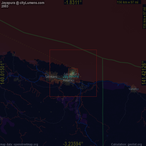
» NASA city lights 2003
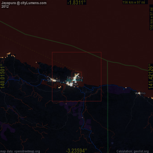
» Earth at Night: Flat Maps 2012, 2016