Banda Aceh night lights from space
Night Light of Banda Aceh (Aceh) from space (Indonesia) Src. Average luminocity for 10x10km area is 81.1942% and for 50x50km: 7.3544%.
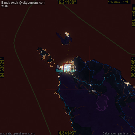

Analysis of Banda Aceh night lights 2016
Square area 10x10 km:
 29.34%
90-99
30.79%80-89
6.4%70-79
7.02%60-69
6.61%50-59
0%40-49
4.55%30-39
9.71%20-29
5.58%10-19
0%0-9
0%Square area 50x50 km:
1.3%90-99
1.38%80-89
0.57%70-79
0.74%60-69
1.41%50-59
0.72%40-49
0.81%30-39
0.97%20-29
2.17%10-19
4.24%0-9
85.69%Clear (daylight) street map image can be seen on geolist.org.
Map coordinates:
6° 14' 27.9" North, 94° 37' 48.8" East
5° 32' 30" North, 95° 19' 60" East
4° 50' 29.1" North, 96° 2' 11.3" East
Some cities around Banda Aceh sort by population:
• Lhokseumawe
205.2 km =127.5 mi,  101°
101°
• Langsa
315.3 km =195.9 mi,  112°
112°
• Reuleuet
111.2 km =69.1 mi, 108°
• Meulaboh
178.5 km =110.9 mi,  150°
150°
• Bireun
156 km =96.9 mi, 103°
• Sabang
38.7 km =24 mi,  357°
357°
• Sigli
71.6 km =44.5 mi, 104°
• Sinabang
359.6 km =223.4 mi,  161°
161°
1215502 (p: 250,757)
Sources (retrieved 2019-11-25):
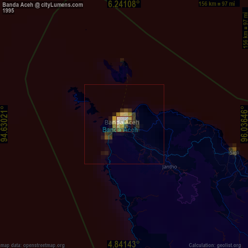
» NASA, Earths city lights 1995
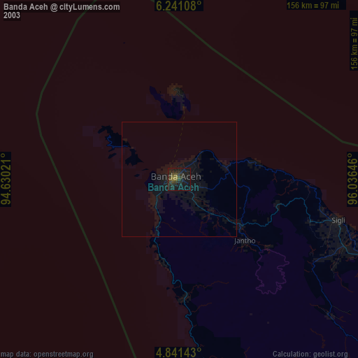
» NASA city lights 2003
» Earth at Night: Flat Maps 2012, 2016