Zaprešić night lights from space
Night Light of Zaprešić (Zagrebačka) from space (Croatia) Src. Average luminocity for 10x10km area is 49.6414% and for 50x50km: 24.0809%.
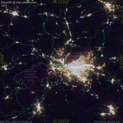
Analysis of Zaprešić night lights 2016
Square area 10x10 km:
 9.97%
9.97%90-99
8.78%80-89
4.17%70-79
1.04%60-69
6.85%50-59
5.51%40-49
8.04%30-39
24.7%20-29
28.42%10-19
2.53%0-9
0%Square area 50x50 km:
6.33%90-99
4.31%80-89
1.63%70-79
2.09%60-69
3.18%50-59
3.27%40-49
3.37%30-39
4.04%20-29
6.75%10-19
8.82%0-9
56.22%Clear (daylight) street map image can be seen on geolist.org.
Map coordinates:
46° 20' 38.1" North, 15° 6' 16.8" East
45° 51' 23" North, 15° 48' 28" East
45° 21' 52.3" North, 16° 30' 39.3" East
Some cities around Zaprešić sort by population:
• Zagreb
14 km =8.7 mi,  109°
109°
• Sesvete
24.1 km =15 mi,  96°
96°
• Stenjevec
7.9 km =4.9 mi,  132°
132°
• Centar
14 km =8.7 mi, 110°
• Samobor
9.1 km =5.7 mi,  229°
229°
• Brezovica
16.2 km =10.1 mi,  150°
150°
• Brežice, SI
17.6 km =10.9 mi,  287°
287°
• Jastrebarsko
24.3 km =15.1 mi,  210°
210°
3186781 (p: 19,664)
Sources (retrieved 2019-11-25):
» Earth at Night: Flat Maps 2012, 2016