Jastrebarsko night lights from space
Night Light of Jastrebarsko (Zagrebačka) from space (Croatia) Src. Average luminocity for 10x10km area is 12.2788% and for 50x50km: 13.5331%.
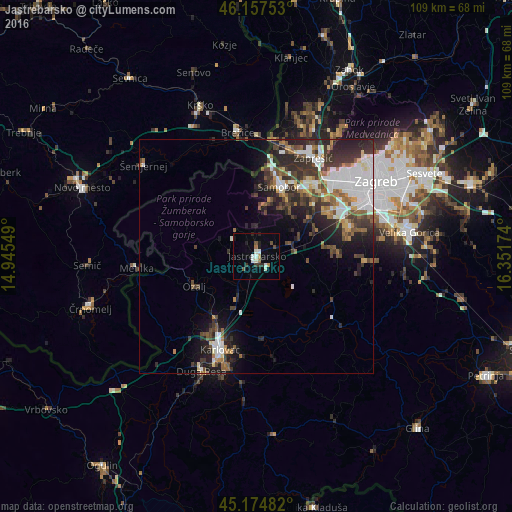
Analysis of Jastrebarsko night lights 2016
Square area 10x10 km:
 1.67%
1.67%90-99
3.18%80-89
0%70-79
0.61%60-69
1.52%50-59
1.06%40-49
1.67%30-39
1.97%20-29
2.42%10-19
2.58%0-9
83.33%Square area 50x50 km:
3.23%90-99
2.22%80-89
0.92%70-79
1.02%60-69
1.65%50-59
1.76%40-49
2.17%30-39
3.09%20-29
4.58%10-19
5.71%0-9
73.65%Clear (daylight) street map image can be seen on geolist.org.
Map coordinates:
46° 9' 27.1" North, 14° 56' 43.8" East
45° 40' 6" North, 15° 38' 55" East
45° 10' 29.4" North, 16° 21' 6.3" East
Some cities around Jastrebarsko sort by population:
• Karlovac
21.1 km =13.1 mi,  201°
201°
• Stenjevec
23.9 km =14.9 mi,  49°
49°
• Zaprešić
24.3 km =15.1 mi,  30°
30°
• Samobor
15.9 km =9.9 mi,  19°
19°
• Brezovica
21.4 km =13.3 mi,  71°
71°
• Brežice, SI
26.5 km =16.5 mi,  350°
350°
• Metlika, SI
26.1 km =16.2 mi,  264°
264°
• Kostanjevica na Krki, SI
26.4 km =16.4 mi,  318°
318°
3198799 (p: 5,445)
Sources (retrieved 2019-11-25):
» Earth at Night: Flat Maps 2012, 2016