Zagreb night lights from space
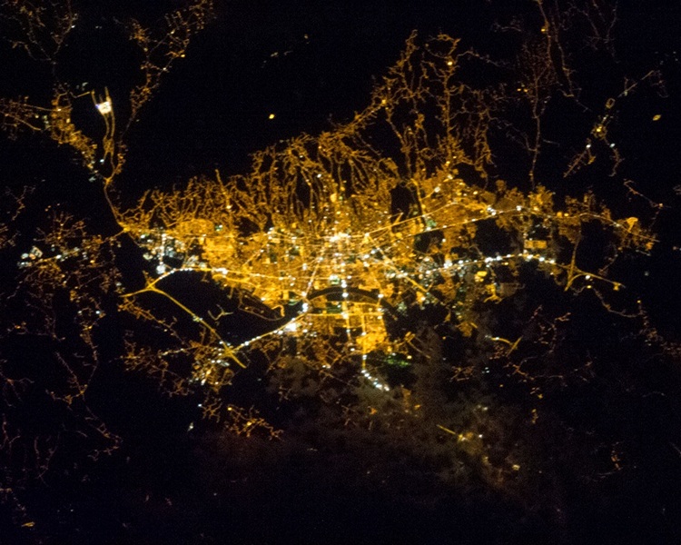
Night Light of Zagreb (City of Zagreb) from space (Croatia) Src. Average luminocity for 10x10km area is 96.2664% and for 50x50km: 26.8447%.
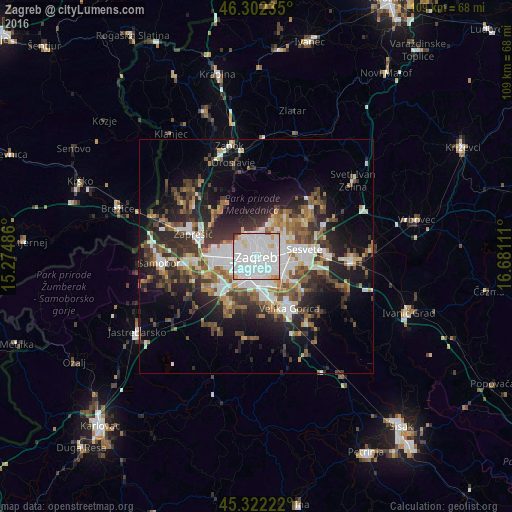
Analysis of Zagreb night lights 2016
Square area 10x10 km:
 65.63%
90-99
22.62%80-89
5.36%70-79
3.13%60-69
0.74%50-59
1.04%40-49
0%30-39
1.49%20-29
0%10-19
0%0-9
0%Square area 50x50 km:
6.69%90-99
4.57%80-89
1.86%70-79
2.25%60-69
3.65%50-59
3.63%40-49
3.95%30-39
4.85%20-29
8.01%10-19
11.68%0-9
48.86%Clear (daylight) street map image can be seen on geolist.org.
Map coordinates:
46° 18' 8.5" North, 15° 16' 29.5" East
45° 48' 52" North, 15° 58' 40.7" East
45° 19' 20" North, 16° 40' 52" East
Fantastic image of Zagreb from space taken by astronauts [src2], but I don't have information about it's orientation, scale or angle. If necessary, it was rotated manually, so North points approximately to upper direction. Click to zoom in:
Some cities around Zagreb sort by population:
• Sesvete
10.9 km =6.8 mi,  80°
80°
• Stenjevec
7.4 km =4.6 mi,  264°
264°
• Centar
0.1 km =0.1 mi,  193°
193°
• Velika Gorica
13.6 km =8.5 mi,  146°
146°
• Zaprešić
14 km =8.7 mi,  289°
289°
• Samobor
20.2 km =12.6 mi,  266°
266°
• Brezovica
10.8 km =6.7 mi,  208°
208°
• Jastrebarsko
30.3 km =18.8 mi,  237°
237°
3186886 (p: 698,966)
Sources (retrieved 2019-11-25):
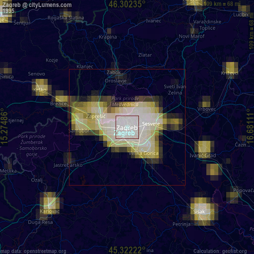
» NASA, Earths city lights 1995
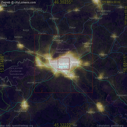
» NASA city lights 2003
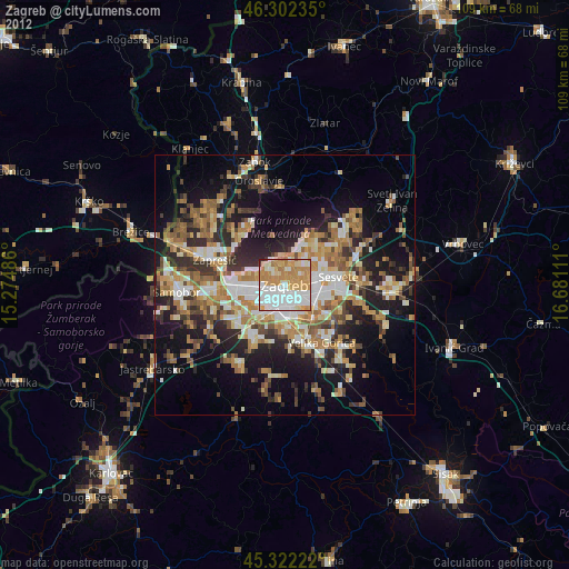
» Earth at Night: Flat Maps 2012, 2016
Src.2: Nasa night light images