Brežice night lights from space
Night Light of Brežice from space (Slovenia) Src. Average luminocity for 10x10km area is 6.9464% and for 50x50km: 11.4328%.
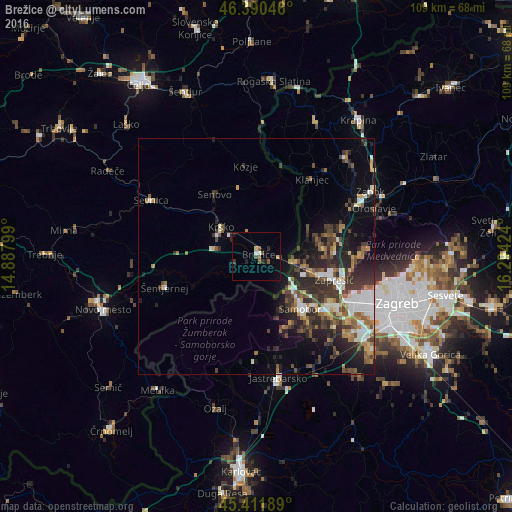
Analysis of Brežice night lights 2016
Square area 10x10 km:
 0.3%
0.3%90-99
0.89%80-89
1.19%70-79
0%60-69
0%50-59
2.38%40-49
1.49%30-39
0.45%20-29
1.93%10-19
2.23%0-9
89.14%Square area 50x50 km:
1.77%90-99
1.59%80-89
0.79%70-79
1.17%60-69
1.75%50-59
1.67%40-49
2.13%30-39
2.71%20-29
4.61%10-19
5.46%0-9
76.35%Clear (daylight) street map image can be seen on geolist.org.
Map coordinates:
46° 23' 25.7" North, 14° 53' 16.8" East
45° 54' 12" North, 15° 35' 28" East
45° 24' 42.8" North, 16° 17' 39.3" East
Some cities around Brežice sort by population:
• Zaprešić, HR
17.6 km =10.9 mi,  107°
107°
• Samobor, HR
14.9 km =9.3 mi,  138°
138°
• Krško
9.9 km =6.2 mi,  308°
308°
• Šentjernej
21 km =13 mi,  250°
250°
• Kostanjevica na Krki
14.5 km =9 mi,  244°
244°
• Kozje
19.2 km =11.9 mi,  352°
352°
• Bistrica ob Sotli
18.2 km =11.3 mi,  18°
18°
• Škocjan
23.2 km =14.4 mi,  270°
270°
3203412 (p: 6,573)
Sources (retrieved 2019-11-25):
» Earth at Night: Flat Maps 2012, 2016