San Marcos night lights from space
Night Light of San Marcos (Ocotepeque) from space (Honduras) Src. Average luminocity for 10x10km area is 7.1515% and for 50x50km: 1.0888%.
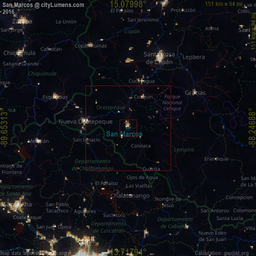
Analysis of San Marcos night lights 2016
Square area 10x10 km:
 0.65%
0.65%90-99
0.22%80-89
2.6%70-79
0.87%60-69
0.22%50-59
0.65%40-49
2.16%30-39
0.43%20-29
3.46%10-19
0%0-9
88.74%Square area 50x50 km:
0.05%90-99
0.11%80-89
0.16%70-79
0.07%60-69
0.13%50-59
0.18%40-49
0.38%30-39
0.23%20-29
0.36%10-19
0.19%0-9
98.15%Clear (daylight) street map image can be seen on geolist.org.
Map coordinates:
15° 4' 47.9" North, 89° 39' 11.3" West
14° 24' 0" North, 88° 57' 0" West
13° 43' 4.6" North, 88° 14' 48.8" West
Some cities around San Marcos sort by population:
• Santa Rosa de Copán
44.7 km =27.8 mi,  24°
24°
• Esquipulas, GT
47 km =29.2 mi,  293°
293°
• Chalatenango, SV
40.8 km =25.4 mi,  177°
177°
• Nueva Concepción, SV
48 km =29.8 mi,  231°
231°
• Nueva Ocotepeque
25.4 km =15.8 mi,  278°
278°
• Gracias
44.9 km =27.9 mi,  61°
61°
• Copán
52.8 km =32.8 mi,  335°
335°
• Suchitoto, SV
52 km =32.3 mi,  189°
189°
3601903 (p: 5,346)
Sources (retrieved 2019-11-25):
» Earth at Night: Flat Maps 2012, 2016