Copán night lights from space
Night Light of Copán from space (Honduras) Src. Average luminocity for 10x10km area is 4.5289% and for 50x50km: 0.7274%.
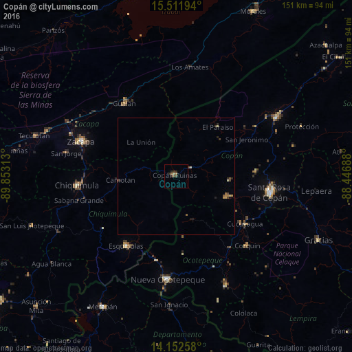
Analysis of Copán night lights 2016
Square area 10x10 km:
 0%
0%90-99
0%80-89
0.83%70-79
0%60-69
1.45%50-59
1.03%40-49
1.24%30-39
2.48%20-29
1.24%10-19
0%0-9
91.74%Square area 50x50 km:
0%90-99
0.03%80-89
0.15%70-79
0.1%60-69
0.13%50-59
0.18%40-49
0.17%30-39
0.17%20-29
0.25%10-19
0.1%0-9
98.73%Clear (daylight) street map image can be seen on geolist.org.
Map coordinates:
15° 30' 43" North, 89° 51' 11.3" West
14° 49' 60" North, 89° 9' 0" West
14° 9' 9.3" North, 88° 26' 48.8" West
Some cities around Copán sort by population:
• Chiquimula, GT
42.7 km =26.5 mi,  265°
265°
• Zacapa, GT
43.7 km =27.2 mi,  290°
290°
• Santa Rosa de Copán
40.5 km =25.2 mi,  100°
100°
• Esquipulas, GT
36.8 km =22.9 mi,  216°
216°
• Gualán, GT
38.8 km =24.1 mi,  325°
325°
• Estanzuela, GT
48.5 km =30.1 mi, 292°
• Nueva Ocotepeque
44.6 km =27.7 mi,  184°
184°
• Florida
40.6 km =25.2 mi,  56°
56°
3613230 (p: 6,336)
Sources (retrieved 2019-11-25):
» Earth at Night: Flat Maps 2012, 2016