Sabá night lights from space
Night Light of Sabá (Colón) from space (Honduras) Src. Average luminocity for 10x10km area is 1.316% and for 50x50km: 0.7632%.
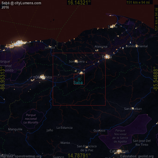
Analysis of Sabá night lights 2016
Square area 10x10 km:
 0%
0%90-99
0%80-89
0%70-79
0.43%60-69
0.87%50-59
0%40-49
0%30-39
0%20-29
0%10-19
0%0-9
98.7%Square area 50x50 km:
0%90-99
0.03%80-89
0.11%70-79
0.16%60-69
0.16%50-59
0.04%40-49
0.15%30-39
0.25%20-29
0.18%10-19
0.13%0-9
98.78%Clear (daylight) street map image can be seen on geolist.org.
Map coordinates:
16° 8' 35.6" North, 86° 57' 11.3" West
15° 28' 0" North, 86° 15' 0" West
14° 47' 16.5" North, 85° 32' 48.8" West
Some cities around Sabá sort by population:
• La Ceiba
65.6 km =40.8 mi,  299°
299°
• Juticalpa
89 km =55.3 mi,  177°
177°
• Tocoa
36 km =22.4 mi,  48°
48°
• Olanchito
34.8 km =21.6 mi,  272°
272°
• Yoro
101 km =62.8 mi,  248°
248°
• Trujillo
59.2 km =36.8 mi,  32°
32°
• Coxen Hole
99.5 km =61.8 mi,  341°
341°
• San Francisco de la Paz
63.2 km =39.3 mi, 175°
3601403 (p: 9,666)
Sources (retrieved 2019-11-25):
» Earth at Night: Flat Maps 2012, 2016