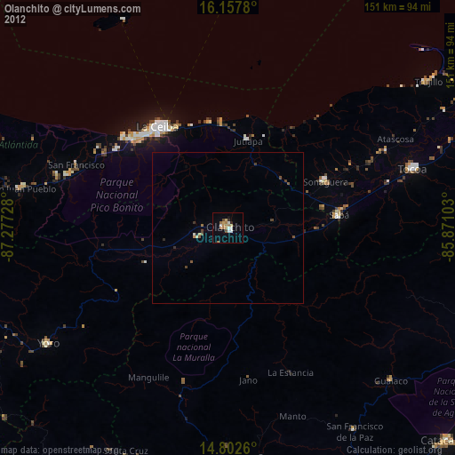
Olanchito night lights from space
Night Light of Olanchito (Yoro) from space (Honduras) Src. Average luminocity for 10x10km area is 18.2208% and for 50x50km: 1.0295%.
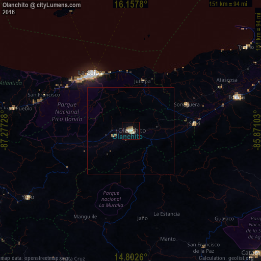
Analysis of Olanchito night lights 2016
Square area 10x10 km:
 1.52%
1.52%90-99
4.55%80-89
3.46%70-79
0%60-69
4.33%50-59
0.87%40-49
1.08%30-39
2.38%20-29
2.38%10-19
4.33%0-9
75.11%Square area 50x50 km:
0.06%90-99
0.18%80-89
0.17%70-79
0.04%60-69
0.19%50-59
0.07%40-49
0.13%30-39
0.18%20-29
0.24%10-19
0.25%0-9
98.51%Clear (daylight) street map image can be seen on geolist.org.
Map coordinates:
16° 9' 28.1" North, 87° 16' 38.2" West
15° 28' 52.7" North, 86° 34' 26.9" West
14° 48' 9.4" North, 85° 52' 15.7" West
Some cities around Olanchito sort by population:
• La Ceiba
38.1 km =23.7 mi,  324°
324°
• Tocoa
65.5 km =40.7 mi,  69°
69°
• Yoro
70.6 km =43.9 mi,  237°
237°
• Santa Rita
83.7 km =52 mi,  245°
245°
• Sabá
34.8 km =21.6 mi,  92°
92°
• Trujillo
82.1 km =51 mi,  53°
53°
• San Juan Pueblo
71.5 km =44.4 mi,  279°
279°
• San Francisco de la Paz
76.1 km =47.3 mi,  148°
148°
3604251 (p: 25,969)
Sources (retrieved 2019-11-25):
» Earth at Night: Flat Maps 2012, 2016