Coxen Hole night lights from space
Night Light of Coxen Hole (Bay Islands) from space (Honduras) Src. Average luminocity for 10x10km area is 15.7583% and for 50x50km: 1.3215%.
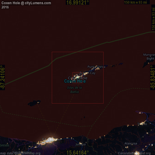
Analysis of Coxen Hole night lights 2016
Square area 10x10 km:
 0%
0%90-99
1.03%80-89
3.51%70-79
1.24%60-69
2.07%50-59
3.72%40-49
3.72%30-39
4.75%20-29
2.48%10-19
1.24%0-9
76.24%Square area 50x50 km:
0%90-99
0.05%80-89
0.25%70-79
0.13%60-69
0.24%50-59
0.28%40-49
0.41%30-39
0.26%20-29
0.16%10-19
0.21%0-9
98.01%Clear (daylight) street map image can be seen on geolist.org.
Map coordinates:
16° 59' 28.4" North, 87° 14' 27.8" West
16° 19' 3.3" North, 86° 32' 16.5" West
15° 38' 29.9" North, 85° 50' 5.3" West
Some cities around Coxen Hole sort by population:
• La Ceiba
67.3 km =41.8 mi,  202°
202°
• Tocoa
91 km =56.5 mi,  140°
140°
• Tela
116.2 km =72.2 mi,  238°
238°
• Olanchito
93.1 km =57.8 mi,  182°
182°
• Sabá
99.5 km =61.8 mi,  161°
161°
• Trujillo
76.7 km =47.7 mi,  125°
125°
• Mezapa
144.2 km =89.6 mi, 235°
• San Juan Pueblo
110.4 km =68.6 mi,  222°
222°
3602736 (p: 7,514)
Sources (retrieved 2019-11-25):
» Earth at Night: Flat Maps 2012, 2016