Bartica night lights from space
Night Light of Bartica (Cuyuni-Mazaruni) from space (Guyana) Src. Average luminocity for 10x10km area is 2.1255% and for 50x50km: 0.0933%.
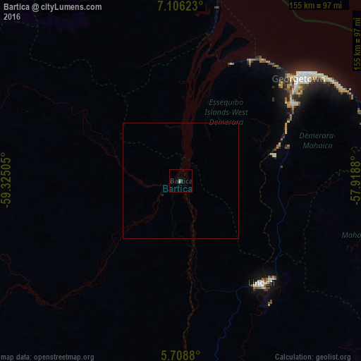
Analysis of Bartica night lights 2016
Square area 10x10 km:
 0%
0%90-99
0%80-89
0%70-79
0.87%60-69
0.87%50-59
0%40-49
0%30-39
1.52%20-29
0.22%10-19
0.87%0-9
95.67%Square area 50x50 km:
0%90-99
0%80-89
0%70-79
0.03%60-69
0.03%50-59
0%40-49
0%30-39
0.06%20-29
0.04%10-19
0.03%0-9
99.79%Clear (daylight) street map image can be seen on geolist.org.
Map coordinates:
7° 6' 22.4" North, 59° 19' 30.2" West
6° 24' 28.8" North, 58° 37' 18.9" West
5° 42' 31.7" North, 57° 55' 7.7" West
Some cities around Bartica sort by population:
• Georgetown
67.8 km =42.1 mi,  49°
49°
• Linden
56.5 km =35.1 mi,  141°
141°
• New Amsterdam
123.4 km =76.7 mi,  98°
98°
• Anna Regina
96.1 km =59.7 mi,  7°
7°
• Rosignol
120.9 km =75.1 mi, 97°
• Mahdia
139.7 km =86.8 mi,  204°
204°
• Vreed-en-Hoop
64.7 km =40.2 mi, 46°
• Fort Wellington
112.5 km =69.9 mi,  90°
90°
3379507 (p: 11,157)
Sources (retrieved 2019-11-25):
» Earth at Night: Flat Maps 2012, 2016