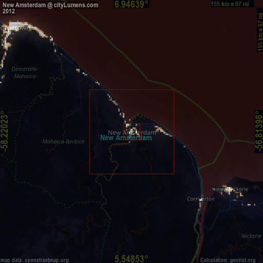
New Amsterdam night lights from space
Night Light of New Amsterdam (East Berbice-Corentyne) from space (Guyana) Src. Average luminocity for 10x10km area is 18.7013% and for 50x50km: 1.5635%.
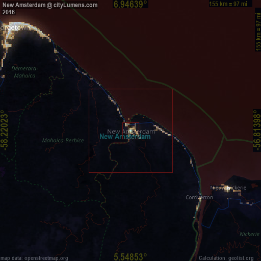
Analysis of New Amsterdam night lights 2016
Square area 10x10 km:
 0.43%
0.43%90-99
0.43%80-89
2.81%70-79
3.9%60-69
0.22%50-59
3.9%40-49
9.09%30-39
6.49%20-29
2.6%10-19
1.95%0-9
68.18%Square area 50x50 km:
0.02%90-99
0.02%80-89
0.18%70-79
0.32%60-69
0.1%50-59
0.28%40-49
0.65%30-39
0.59%20-29
0.36%10-19
0.2%0-9
97.29%Clear (daylight) street map image can be seen on geolist.org.
Map coordinates:
6° 56' 47" North, 58° 13' 12.8" West
6° 14' 52.5" North, 57° 31' 1.6" West
5° 32' 54.7" North, 56° 48' 50.3" West
Some cities around New Amsterdam sort by population:
• Georgetown
93.8 km =58.3 mi,  311°
311°
• Linden
91.3 km =56.7 mi,  253°
253°
• Nieuw Nickerie, SR
70 km =43.5 mi,  120°
120°
• Bartica
123.4 km =76.7 mi,  278°
278°
• Skeldon
58.7 km =36.5 mi,  133°
133°
• Rosignol
3.4 km =2.1 mi,  319°
319°
• Vreed-en-Hoop
97.7 km =60.7 mi, 309°
• Fort Wellington
18.6 km =11.6 mi,  328°
328°
3376762 (p: 35,039)
Sources (retrieved 2019-11-25):
» Earth at Night: Flat Maps 2012, 2016