Rosignol night lights from space
Night Light of Rosignol (Mahaica-Berbice) from space (Guyana) Src. Average luminocity for 10x10km area is 14.1039% and for 50x50km: 1.5208%.
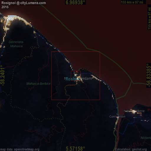
Analysis of Rosignol night lights 2016
Square area 10x10 km:
 0.43%
0.43%90-99
0.43%80-89
2.81%70-79
2.6%60-69
0.22%50-59
2.6%40-49
5.41%30-39
4.11%20-29
3.9%10-19
1.52%0-9
75.97%Square area 50x50 km:
0.02%90-99
0.02%80-89
0.15%70-79
0.32%60-69
0.1%50-59
0.24%40-49
0.67%30-39
0.61%20-29
0.36%10-19
0.2%0-9
97.33%Clear (daylight) street map image can be seen on geolist.org.
Map coordinates:
6° 58' 9.8" North, 58° 14' 24.4" West
6° 16' 15.4" North, 57° 32' 13.1" West
5° 34' 17.7" North, 56° 50' 1.9" West
Some cities around Rosignol sort by population:
• Georgetown
90.5 km =56.2 mi,  310°
310°
• Linden
90 km =55.9 mi,  251°
251°
• New Amsterdam
3.4 km =2.1 mi,  139°
139°
• Nieuw Nickerie, SR
73.2 km =45.5 mi,  121°
121°
• Bartica
120.9 km =75.1 mi,  277°
277°
• Skeldon
62 km =38.5 mi,  134°
134°
• Vreed-en-Hoop
94.4 km =58.7 mi, 309°
• Fort Wellington
15.2 km =9.4 mi,  331°
331°
3376223 (p: 5,782)
Sources (retrieved 2019-11-25):
» Earth at Night: Flat Maps 2012, 2016