Georgetown night lights from space
Night Light of Georgetown (Demerara-Mahaica) from space (Guyana) Src. Average luminocity for 10x10km area is 63.2511% and for 50x50km: 8.4836%.
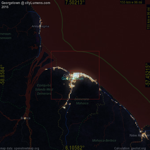
Analysis of Georgetown night lights 2016
Square area 10x10 km:
 17.32%
90-99
24.68%80-89
5.19%70-79
4.98%60-69
1.52%50-59
2.6%40-49
6.06%30-39
6.93%20-29
20.35%10-19
10.17%0-9
0.22%Square area 50x50 km:
0.8%90-99
1.57%80-89
1.67%70-79
0.93%60-69
0.65%50-59
0.73%40-49
1.25%30-39
1.02%20-29
2.71%10-19
6.74%0-9
81.94%Clear (daylight) street map image can be seen on geolist.org.
Map coordinates:
7° 30' 7.7" North, 58° 51' 30.2" West
6° 48' 16.1" North, 58° 9' 19" West
6° 6' 21" North, 57° 27' 7.7" West
Some cities around Georgetown sort by population:
• Linden
90.1 km =56 mi,  190°
190°
• New Amsterdam
93.8 km =58.3 mi,  131°
131°
• Anna Regina
64.2 km =39.9 mi,  322°
322°
• Bartica
67.8 km =42.1 mi,  229°
229°
• Skeldon
152.5 km =94.8 mi, 132°
• Rosignol
90.5 km =56.2 mi, 130°
• Vreed-en-Hoop
4.7 km =2.9 mi,  276°
276°
• Fort Wellington
76.3 km =47.4 mi, 127°
3378644 (p: 235,017)
Sources (retrieved 2019-11-25):
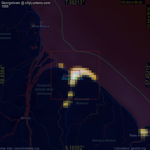
» NASA, Earths city lights 1995
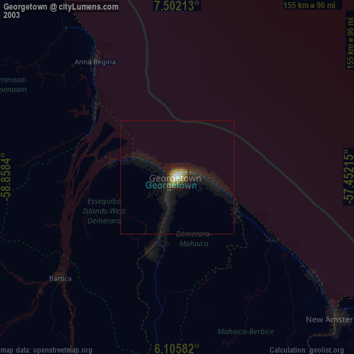
» NASA city lights 2003
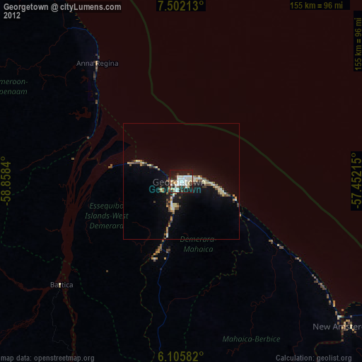
» Earth at Night: Flat Maps 2012, 2016