Zacualpa night lights from space
Night Light of Zacualpa (Quiché) from space (Guatemala) Src. Average luminocity for 10x10km area is 0.0207% and for 50x50km: 0.3466%.
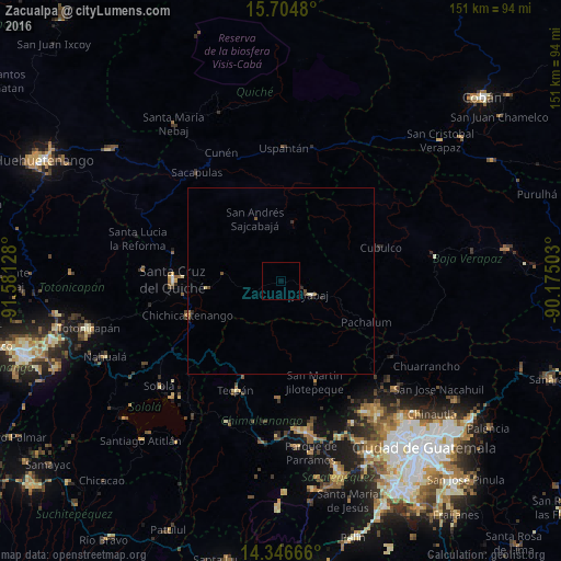
Analysis of Zacualpa night lights 2016
Square area 10x10 km:
 0%
0%90-99
0%80-89
0%70-79
0%60-69
0%50-59
0%40-49
0%30-39
0%20-29
0%10-19
0%0-9
100%Square area 50x50 km:
0%90-99
0.04%80-89
0.09%70-79
0.01%60-69
0.02%50-59
0.07%40-49
0.14%30-39
0.02%20-29
0.17%10-19
0.03%0-9
99.4%Clear (daylight) street map image can be seen on geolist.org.
Map coordinates:
15° 42' 17.3" North, 91° 34' 52.6" West
15° 1' 36.5" North, 90° 52' 41.3" West
14° 20' 48" North, 90° 10' 30.1" West
Some cities around Zacualpa sort by population:
• Chichicastenango
26.7 km =16.6 mi,  249°
249°
• Santa Cruz del Quiché
29.1 km =18.1 mi,  270°
270°
• Tecpán Guatemala
31.9 km =19.8 mi,  202°
202°
• Comalapa
31.8 km =19.8 mi,  181°
181°
• Joyabaj
9 km =5.6 mi,  114°
114°
• San Martín Jilotepeque
28.9 km =18 mi,  161°
161°
• Cubulco
28.1 km =17.5 mi,  72°
72°
• San José Poaquil
23.5 km =14.6 mi,  189°
189°
3587578 (p: 9,241)
Sources (retrieved 2019-11-25):
» Earth at Night: Flat Maps 2012, 2016