Comalapa night lights from space
Night Light of Comalapa (Chimaltenango) from space (Guatemala) Src. Average luminocity for 10x10km area is 1.7169% and for 50x50km: 6.3391%.
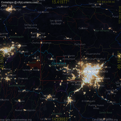
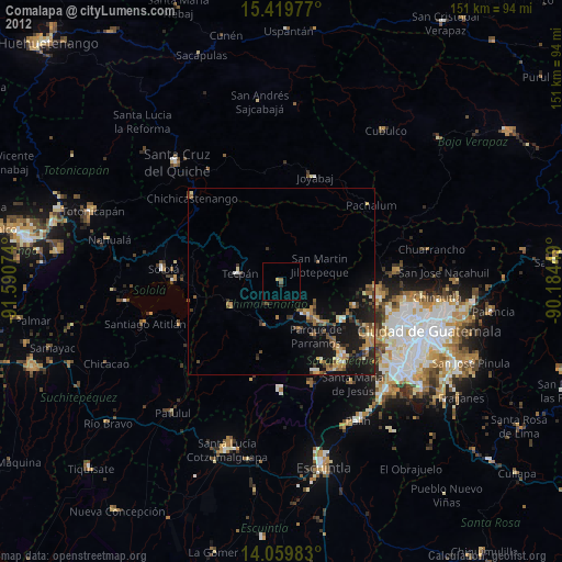
Analysis of Comalapa night lights 2016
Square area 10x10 km:
 0%
0%90-99
0%80-89
0%70-79
0%60-69
1.03%50-59
0.62%40-49
0%30-39
0.83%20-29
0%10-19
0%0-9
97.52%Square area 50x50 km:
0.12%90-99
0.37%80-89
0.71%70-79
0.89%60-69
1.59%50-59
1.12%40-49
1.16%30-39
1.29%20-29
2.29%10-19
6.93%0-9
83.54%Clear (daylight) street map image can be seen on geolist.org.
Map coordinates:
15° 25' 11.2" North, 91° 35' 26.7" West
14° 44' 27.1" North, 90° 53' 15.4" West
14° 3' 35.4" North, 90° 11' 4.2" West
Some cities around Comalapa sort by population:
• Chimaltenango
11.5 km =7.1 mi,  140°
140°
• Tecpán Guatemala
11.5 km =7.1 mi,  281°
281°
• San Andrés Itzapa
14 km =8.7 mi,  160°
160°
• Patzicía
12.8 km =8 mi,  199°
199°
• San Martín Jilotepeque
11.1 km =6.9 mi,  66°
66°
• Zaragoza
10.1 km =6.3 mi,  181°
181°
• Santa Cruz Balanyá
7.1 km =4.4 mi,  208°
208°
• San José Poaquil
9 km =5.6 mi,  342°
342°
3598034 (p: 20,738)
Sources (retrieved 2019-11-25):
» Earth at Night: Flat Maps 2012, 2016